Early in the last century, one highway paved the way—literally and figuratively—for the roads we enjoy today. More patchwork quilt than a continuous ribbon, it was stitched together from existing roads to create a route from Times Square in New York City to Lincoln Park in San Francisco.
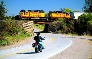
Although it existed officially for only 15 years, the “Father Road” is still out there, tucked between fence rows, bordering town squares. So on an early October weekend, my brother Kevin and I have packed the bikes for a day trip and are setting out to find part of this highway that no longer exists. My Honda Shadow ACE is polished. His Kawasaki KLR650—well, it’s as shiny as a KLR gets.
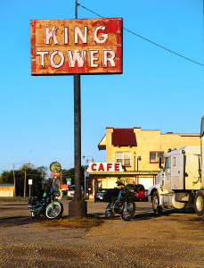
We’ve chosen the King Tower Café in Tama, Iowa, as our launch point. Jimmy, the owner, may hail from Albania, but the cooking here is straightup heartland, befitting Iowa’s first truck stop. Besides the food, we’re here for the same reason that the café is here: because of the historic roadway running past the front door.
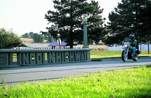
After fueling up on the breakfast special and coffee, we fire up the bikes and putter a few hundred yards down the road to a bridge spanning a tiny creek. It’s literally a concrete reminder that the nation’s first coast-to-coast highway ran through here. The pillars supporting the bridge railings spell out “Lincoln Highway.”
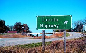
The Lincoln Highway was conceived by Carl Fisher and championed by Henry Joy and Frank Sieberling at a time when it could be difficult to find a decent road from one town to the next. The men had good reason to back a venture that would encourage travel by horseless carriage: Fisher manufactured automobile lights, Joy was president of Packard, and Sieberling had a company called Goodyear. In September 1913, their Lincoln Highway Association announced a route. And their idea worked. A cross-country trip that took longer than two months in 1913 could be made in less than a week by 1915.
Along the way, local entrepreneurs provided food, fuel and overnight facilities. In 1927, after the federal government took control of routing and building roads, the Lincoln Highway Association was disbanded and much of the route became U.S. 30. Our goal is to ride as much of the original L.H. as we can find in this part of the state and to see some of the artifacts that remain. Like this bridge.
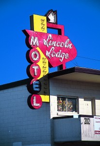
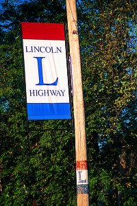
Lincoln Highway banners fluttering on telephone poles guide us west out of Tama to county road E49, an Iowa Scenic Byway and the original path of the Lincoln. The bikes lean gently as the road winds through the wide Iowa River valley. This is also the heart of the settlement of the Sac and Fox tribes in Iowa. Not far down the road we roll past what appears to be an athletic park, with bleachers and softball or soccer fields. It’s actually the ceremonial grounds for the tribes and part of the original 80 acres purchased from the state in 1857. The pow-wow held here each August draws thousands of Native Americans and visitors.
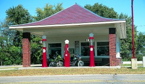
In Montour, we see the boarded-up shells of two canopied gas stations that served L.H. travelers. We turn north at the second one for a short jaunt to U.S. 30. Between here and Marshalltown, 30 follows the original Lincoln Highway route. Beyond that, it skirts around almost every town the L.H. went through. One exception is LeGrand. But progress is unstoppable: By next spring, a new four-lane bypass will open around the north side of town. Another section of the Lincoln will transition from highway to byway.
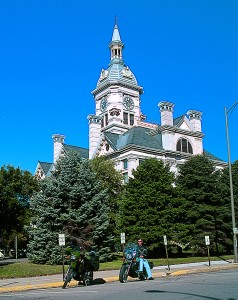
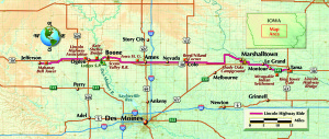
The old route zigs and zags as it cuts across the state, so I’m glad one saddlebag holds my copy of The Lincoln Highway Iowa Map Pack. Each page details the original route through one county. We pull over east of Marshalltown to refer to this low-tech GPS. It says we’re a stone’s throw from an L.H. landmark, the Shady Oaks campground. Travelers have been resting here beside the creek, in the shade of the burr oaks, since 1848. A more recent addition is a 5,000-square-foot, 12-story tree house complete with electricity, phone and running water. Really. It’s privately owned, so you’ll have to call ahead to arrange a tour. Winding through Marshalltown, the Lincoln eventually becomes Main Street. And not by chance, because it was up to local officials to route the road. So of course, they guided motorists (and their wallets) past as much local enterprise as possible. In the heart of town, the windows of well-preserved and well-stocked storefronts reflect the ornate courthouse. It almost looks like we’ve ridden back to 1952. It’s a perfect example of why the Lincoln’s unofficial designation was “The Main Street of America.”
Riding west, the rolling hills begin to flatten out. The Lincoln runs arrow-straight to Colo where one of the gems of the route has recently been restored. Reed/Niland Corner is where travelers winding from Winnipeg to New Orleans on the Jefferson Highway crossed paths with those on the Lincoln. Here, Charlie Reed opened a Most of the buildings, including the canopied gas station, remain. All that’s needed are a couple of motorcycles and a glowing sunset to make it look like a Dave Barnhouse painting. The café is open for business, so we grab the last two seats in the place, order giant tenderloins (10 inches across!) and browse the great display of L.H. memorabilia. If you explore the rest of the grounds, note that the motel has been converted to apartments, so respect the privacy of the tenants.
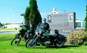
On the road after lunch, we have to stop to admire the beautiful marble markers welcoming us to Nevada (say “nuh-VAY-duh” if you want to sound local.) Then it’s on to Ames, home of Iowa State University, one of the nation’s premier land-grant institutions. Today the Cyclones are playing at Jack Trice Stadium and the campus is vibrating with the energy of a football Saturday.
Our map pack guides us past the ISU campus on the main thoroughfare, Lincoln Way. West of Ames, we turn north for a mile, then cut west again on 210th Street. Don’t let the bigcity-sounding street name fool you. This is a more realistic taste of the original Lincoln Highway. The road is gravel.
Still, it’s better than what confronted Lincoln travelers 90 years ago. They often had just two tracks of dirt between farm fields. And if it rained, Iowa’s fertile soil turned into a tire-sucking gumbo. Many farmers supplemented their income with a team of horses ready to rescue stuck motorists.
This road is well maintained, though, with three hard-packed tracks separated by low ridges of gravel. Kevin’s KLR looks more at home here than my Shadow. The gravel can make the bike feel a bit loose, but I just keep my head up, my speed down, and favor the rear brake when slowing.
As gravel clinks inside the fenders, it occurs to me that traveling by motorcycle is not so far removed from traveling by Model T. You’re out there in the wind and the weather, with just a jacket, gloves and boots for climate control. And at times, we, too, startle dogs and small children.
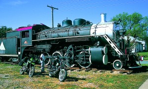
It’s back to pavement as we approach Boone. For a town of only 12,500, Boone is a destination unto itself. Mamie Eisenhower was born here and the street we’re on is named after her. For fans of heavy metal, there are literally tons of attractions at the Boone and Scenic Valley Railroad. One of the last steam locomotives ever made resides here and pulls excursion trains on weekends. If you climb on board, stick your head out the window and look down as you cross the Scenic Valley High Bridge—it stands 156 feet above Honey Creek and is barely wider than the train. It’s like flying at 12 miles per hour.
There are plenty of diversions in Boone, so you may want to stay overnight. There’s great camping a few miles south at Ledges State Park, where the Des Moines River has carved the limestone bluffs. On weekends, you’ll see lots of bikes riding the park.
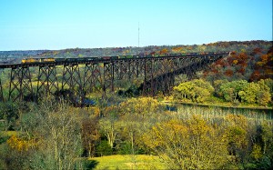
This stretch of the river attracts canoeists from all over the state. Paddling under the sky-high railroad bridges is one of the reasons. The most famous, the century-old Kate Shelley Bridge, stretches almost 2,400 feet across the valley, 186 feet in the air. In 1881, in a howling rainstorm, 15-year-old Kate Shelley crawled over a damaged trestle near here to flag down a passenger train, preventing a disaster. The Union Pacific railroad still runs 60 trains a day over the double-track trestle named in her honor.
Out of the river valley, it’s on to Ogden, a special place for the L.H. The Lincoln Highway Association was reborn here in 1992 to help preserve the road’s legacy. Stop by the headquarters in Ogden and you might bump into Bob or Joyce Ausberger, driving forces behind both the Iowa and the National L.H.A.
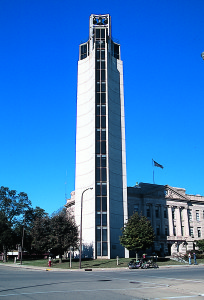
Four miles before Jefferson, we spot our next destination straight ahead. Rising like an exclamation point out of the prairie, it’s far skinnier than the water towers and grain elevators that break the horizon to mark other towns. In just a few minutes we’ll switch off our bikes’ engines and let the carillon of the 162-foot-tall Mahanay bell tower soothe our ears.
In 1947, Floyd Mahanay, a local medical supplies salesman, left the city of Jefferson $350,000 with one ironclad condition: build a bell tower. So they did. The observation deck is open Memorial Day through Labor Day, but I’ve called ahead to Bob Owens of the L.H.A. and arranged a trip to the top in the glass elevator. From here we trace the L.H. to the west, disappearing under a canopy of trees.
This late in the season, the sun is dropping quickly, so Kevin and I decide to turn east for home. But Owens has piqued our interest with stories of the well-preserved 1930s-era pavement just west of town, with narrow lanes, grass in the cracks and cornfields hugging the shoulders. Beyond that it’s just 1,800 miles to San Francisco….
(This article Lincoln Log: Day-Tripping on the Father Road was published in the October 2005 issue of Rider magazine)



Please change your descriptions under the photos of Niland’s Cafe and the intersection of the Lincoln and Jefferson Highways to indicate that it is located near the town of Colo, Iowa, not Colorado.
Thank you Axzi! Sometimes spell check doesn’t quite work right as it seems to have thought Colo was the abbreviation for Colorado. Our mistake. Thank you for letting us know. The change has been made.