We were down at the bottom of the canyon, right by the bridge at La Bufa that crossed over the churning, frothing Batopilas River, huddling under an overhang to protect us from the rain. The seven of us had just descended thousands of feet on 20 miles of rough dirt switchbacks, and one of our group found that his motorcycle had sprung a leak in the cooling system. Nick quickly figured that he wasn’t going to fix the problem then and there, but he could ride the 20 muddy miles following the river down to the town of Batopilas. The rain would help to keep the engine cool, and he could fill the radiator at the many little streams that crossed the road. We took off.
There are those who want the simple, the comfortable life, with smooth roads and the sun behind them. Then there are those who like a bit of a challenge, a small adventure. The latter are the kind of riders who will sign up with Rosen’s Rides’ Advanced Copper Canyon Tour, down south of the Border way. This is a trip for dual-purpose motorcycles, with bad roads and river crossings being the norm. No Gold Wings nor Harleys need apply.
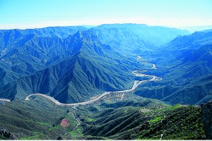
I signed on to the December tour, a month that is usually dry and cool in Chihuahua, one of the largest of the 31 United Mexican States. We would be as high as 7,600 feet on the rim of the Copper Canyon Nature Park at Creel, down to 1,600 feet at the bottom. The park consists of three really huge canyons, each one bigger than our Grand Canyon, with rivers that combine to eventually flow out to the Sea of Cortez. A hundred years ago these canyons were noted for their gold and silver ore, plus a little copper, and whole towns were built, with mansions and smelters. Now these once-sophisticated communities mostly rely on a little hardscrabble mining, a bit of agriculture and the evergrowing tourist industry.
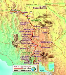
The trip began in Douglas, Arizona, where host Justin Lopez met us six clients, loaded all our gear in his pickup, helped to handle the paperwork at the border, and we headed south toward Copper Canyon, over 400 miles away. An arctic wave having chosen to flow through the Southwest, we were properly bundled. We split the trip by spending the night in a middling-sized town called Gomez Faria, to wake up to a damp, drizzly day. Then on to Creel, where a pleasant Best Western lodge had gas stoves in each room, great for drying clothes.
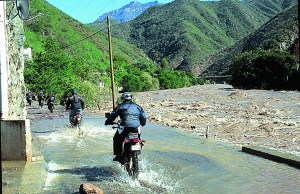
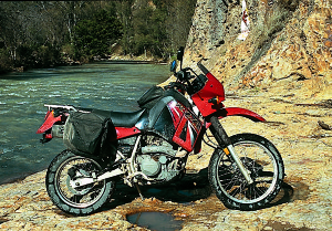
Now began the real trip, down into the canyons. Justin was leading us on a Kawasaki KLX400, and his brother-inlaw Raoul followed in the truck. The trick to happy dualsporting is not having to carry any gear, just you and the bike scrabbling up and down the mountains. That is fun! Tires should be reasonably knobby, but I was sporting the least knobbly of all, with a set of Dunlop K750s on a new KLR650 that Kawasaki had been kind enough to loan me for the trip. The tires did the job, but in some 30-foot-long mudholes I was a bit anxious.
It was an overcast day leaving Creel, and after an hour we turned off the pavement and began the precipitous descent into the canyon. At the higher altitudes we were riding through piney woods, until at one point the right side of the road disappeared. No Armco barriers, no nothing. To the left was the side of a mountain going up, to the right, the side of a mountain going down on a 60-degree slope. No view, just gray clouds, but Justin assured us that down there, way down there, was La Bufa and a bridge. Then it began to rain.
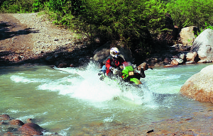
Down we went, roosting out of the corners, having a fine time, only our sense of mortality keeping us in check. From the bridge we covered the 20 muddy miles into Batopilas in an hour, though Nick required two and a half. After which he took the radiator off his bike and JB-welded the hole; a competent man, him. A rainy dusk, the lights went on, and then went off, to stay off for the night. We were in a delightful old courtyarded house that had been made into a hotel, and kerosene lanterns now lit our rooms. And the rain poured down.
In the morning we woke to no rain, but the entire town was out looking at the river raging by. Our itinerary was changing due to flooding. Instead of going down along the river to the old mission at Satevo, fording the bridgeless Urique River, spending the night at Tubares, and then on to the town of Urique, we were headed back up to Creel. Ningún problema, as the locals might say, because riding the switchbacks up was even more fun than going down. Also, the skies were spectacularly clear and blue, the canyon showing off its glamour; we had great weather for the rest of the trip.
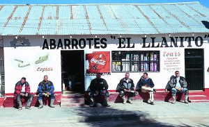
A night in Creel, and then on to Urique, via the mildly famous El Divisadero, where two daily tourist trains that run from the city of Chihuahua down the coast, and vice versa, always stop, and the local Tarahumara Indians profit from the travelers’ need to bring cultural objects home, to prove they have been somewhere. These mountains are home to the Tarahumaras, a gentle tribe numbering some 75,000, who have lived contentedly in this steep terrain for hundreds of years. They are noted for their basket-making skills, their braided bracelets and their running ability, and most have willingly avoided the money-based economy, thanks to the inaccessibility of their small villages. They rely on hunting, tending some animals and raising a few crops; none of this 9-to-5 rat-race for these folk—except for the souvenir sellers who operate on the train schedule.
Near the town of San Rafael we left the pavement behind and Justin had to make the decision as to whether we would take the high road or the low road to Bahuichivo. Several truck drivers said there was too much water on the low, so we took the high. After Bahuichivo began the down and down and down to the little town of Urique on the Urique River, once famous for its silver, now sleepily passing the years away. The greatest difficulty we had was in trying to combine our admiration for the views and to stay on the road. An overlook some 4,000 feet above Urique gave us a magnificent view of the canyon as it twisted south through the mountains.
Like Batopilas, Urique is a one-street town, paralleling the river, and the river was in full flood. We were glad not to be trying to ford it.
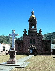
Great dinner, quiet night, and then we headed back up the mountain to the little pueblo of Cerocahui, home to a lovingly restored 17th-century mission, and a local red wine called Mision de Cerocahui, thanks to the padres of yore planting grapes for communion services. A mile beyond the town is the Copper Canyon Moto Lodge, which is the home of Rosen’s Rides, a nice establishment on a hill above a river, with lots of hot water and wood-fired stoves in each room. Justin has major plans for expanding the place. A big bonfire was built, and Justin’s wife, Orelia, with the help of some of her relations, prepared a noble feed, while Nick entertained us with tales of vampire bats.
Morning, and we would take the low road back from Bahuichivo to San Rafael. And what a road it was! Things that are too easy often have no flavor, and this had all the flavor anyone could want. Half the time the road paralleled the railroad tracks, which meant it was rather flat, but did require us to ford the same river six times, which was still running high. Everybody made it, except the chase truck got stuck once and had to be pushed out. Leaving the railroad the road went up very steeply, the kind of steep where you can’t stop because if you put on the front brake you will just slide backward. Marvelous fun! Best single stretch of road of the trip, we all agreed, once back in San Rafael.
Then it was pavement back to the border, going via Creel to Gomez Farias for another night, and on to Agua Prieta/ Douglas. Good trip. Tough trip. Which was the way we all wanted it.
Pliers and Wire
In Mexico it is said that most problems can be fixed with a pair of pliers and a bit of wire; there is a bit of truth in that. But the Rosen’s Rides support vehicle carries more than that, and takes the worry out of having a breakdown. The company, operating since 1999, offers several different tours, all centered on Copper Canyon, all dual purpose in design. This Advanced trip is the toughest, and riders who sign up should not overestimate their skills. The accommodations were good, the food was excellent and the roads challenging, as promised. Tours usually begin on the U.S./Mexico border, in order to help with the paperwork, but they can also start in Creel. Most clients bring their own bikes, but RR does rent KLR650s for those who want to fly and ride.
The Copper Canyon Moto Lodge (480-836-8386 or info@rosensrides.com) is also available to riders who want to explore Copper Canyon on their own; it’s a good place to leave your bags while you go off and flounce around the canyons unencumbered.
For more information see www.rosensrides.com or contact Rosen’s Rides, 15280 East Lotus Lane, Fountain Hills, Arizona 85268; (800) 549-7033.
(This article LOOKING FOR BAD ROADS: Traveling to Mexico’s Copper Canyon Nature Park with Rosen’s Rides, was published in the April 2005 issue of Rider.)
 |
 |


Hello
The following are our 2018 hotel rates contract for
Hotel Torres Del Fuerte, a boutique hacienda hotel, in El Fuerte Sianaloa (gateway to the Copper Canyons!)
http://www.torresdelfuerte.com
http://www.torrestravelco.com
\
We have other points of interest in the way to the canyons such as http://www.casasantuariosc.com (san carlos), http://www.bonifacios.com (san carlos and el fuerte), casa torres (navojoa sonora)
Please let us know if we can be of service to you and your company
Thank you
Francisco Bonifacio Torres
tel 622 109 0031
email fraboto@yahoo.com
Hola. My wife and I will be traveling to Mazatlan in Mid November in our pickup truck towing my motorcycle. We plan on traveling through the Copper Canyon area. We are interested in riding the motorcycle around Copper Canyon as much as we can. So we would be making some hotel our “home base” and travel from there. My motorcycle is not a dual sport but can handle dirt and gravel roads just fine. My wife would prefer to stay on paved roads. I was wondering if what I am suggesting is possible and where would I find some routes and hotels to stay at. Any help would be greatly appreciated. Gracias