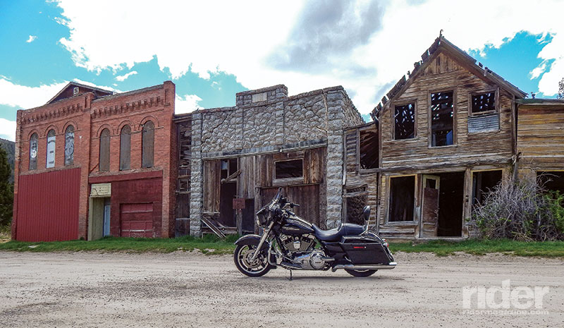
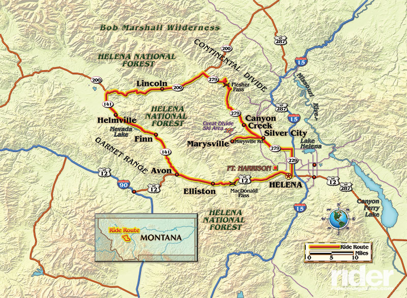
Living in Montana, known by some as “The Last Best Place,” it is easy to find great roads for a short run or a longer weekend excursion. Kim and I begin our ride in our new hometown of Helena, the state capital. From the capitol building, we turn north on Montana Avenue, heading for the Lincoln Highway, a.k.a. State Highway 279. It runs through ranch country with rolling hills and valleys. Marysville is our first stop. Back in the 1880s, it was a roaring gold mining town, with more than 3,000 residents before most of the mines played out. Several buildings remain in the downtown area, including the Falling Rock Theater and the local Masonic Lodge. The Drumlummon Mine, the largest mine in Marysville, was active until just a few years ago. The Marysville House is a great place for a steak and a cold beer and sits across from the remnants of downtown.
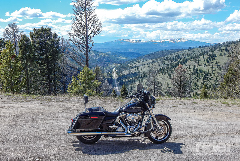
Departing Marysville, we continue north on Highway 279 to Canyon Creek, climbing up to Flesher Pass, 6,000 feet of pure bliss. This road has to be one of the best-kept secrets in the Treasure State, with more than 6 miles of switchbacks, sweepers and views of the valley, where you can see the Lincoln Highway as it disappears into a horizon of snowcapped mountains. After stopping at several pullouts for photos, we head down sharp switchbacks to level roadway. We want to get to our next stop in Lincoln before it gets too late in the afternoon, so off we head, now to the northwest.
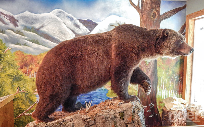
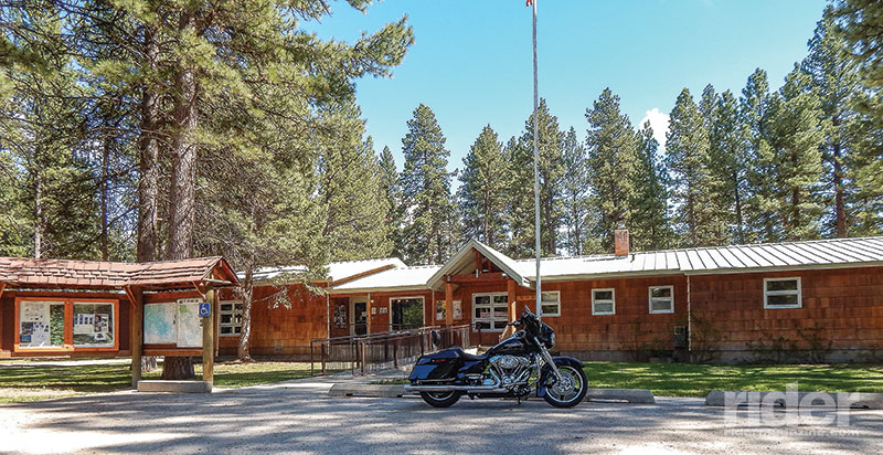
Highway 279 meanders along Willow Creek, a fine spot to see the occasional bald eagle and keep an eye out for mule deer. Turning west on Highway 200 we are on fine, newly rebuilt highway that bisects Montana from east to west, with some of the most interesting little towns along the way. One such town is Lincoln. It has one major street, with several bars, hotels and gas stations, and one very unique former resident—the Lincoln Bear. This grizzly was well known in and around town, having become proficient at rummaging through the trashcans of the citizenry. But his luck ran out on October 17, 2007, when he was struck and killed by a pickup on Highway 200 about five miles west of Lincoln. The Lincoln Bear was mounted and eventually put on display in the front window of the Forest Service office on the east side of town. If you get a chance, stop by and see him to get an idea of what an 830-pound grizzly looks like up close.
As we ride west along Highway 200, we parallel the Blackfoot River and the Bob Marshall Wilderness area just to the north. “The Bob” encompasses more than one million acres of nearly roadless valleys and mountains. We continue on 200 for several miles until we reach Highway 141, taking it south. Highway 141 sweeps left and right along the rolling foothills of the Garnet Mountains and we see more cattle than people or vehicles. Around one hill we are surprised to find an Angus steer in the road, having escaped the fenced-in confines of the pasture.
Soon we pass Highway 271, heading west to tiny Helmville before becoming an outstanding little canyon road, terminating at Interstate 90 near Drummond. Continuing on Highway 141, ahead is Nevada Lake. It offers fishing in both summer and winter, as ice fishing is quite popular. Pushing forward we arrive at Avon, where Highway 141 dead-ends into U.S. Route 12. A left on U.S. 12 and the traffic picks up remarkably, since it’s the main artery between Missoula and Helena.
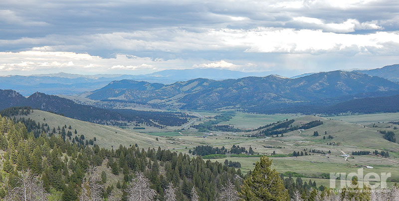
Riding up a gently winding four-lane road to the top of MacDonald Pass at just over 6,000 feet, there’s a remarkable view of the Rimini area in the valley floor below. Down the other side it is not so gentle, with an
8-percent grade for the next 6 miles. On down we go until we finally reach the bottom and make our way past Fort Harrison and into Helena. Whether the desire is to hike, fish or just sightsee, the Lincoln Loop can fill the bill!


 | Ep. 69 Rider Magazine Insider Podcast")


You neglected to mention Lincoln’s most famous past resident the Unabomber Ted Kozinski!
And is the Flesher Pass road paved?