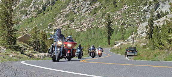
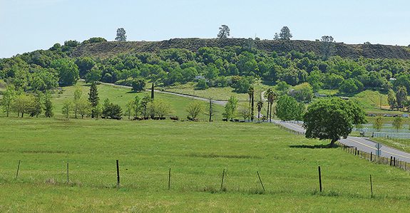
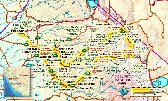
Our ride with the Sacramento Road Cruisers today starts in Folsom, California, and heads out of town via Latrobe Road through rural Sacramento County, past cattle ranches and oak woodlands. From there, State Route 49 take us south, twisting and turning for 300 miles through the foothills of California’s Gold Country, with the northern end passing over the Sierra Nevada Mountains at Yuba Pass.
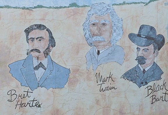
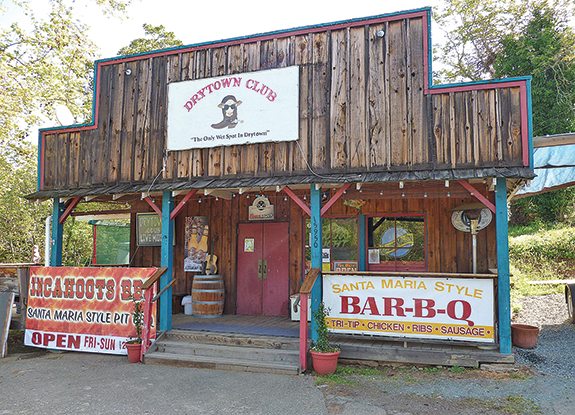
The first small town we hit on Route 49 is Drytown, where the Drytown Club is the last remaining saloon of 25 that used to entertain the town back in the gold rush era. Moving on, we pass through Sutter Creek, Jackson and, after some nice curves, Mokelumne Hill, before taking a short break in San Andreas. This was said to be a rendezvous for infamous gold-rush outlaw Joaquin Murrieta, and then, 30 years later, Black Bart. After San Andreas, the next town we pass through is Angels Camp, which Mark Twain fans will recognize as the setting for The Celebrated Jumping Frog of Calaveras County.
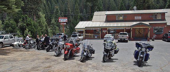
Past Angels Camp, we turn on Rawhide Road to avoid the congestion of Sonora, and hit State Route 108, where we turn east and start our trip into the mountains. In a few miles, we climb from about 2,000 feet to 4,000 and the landscape changes from the oaks of the foothills to the pines of the mountains. The first part of the road is an easy climb to our lunch stop at the Strawberry Inn.
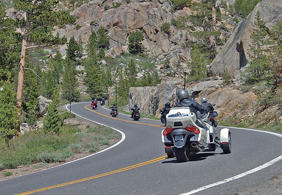
After lunch, the road continues to climb through the forest and around some moderate corners. The Donell Reservoir glistens in the canyon below us. When we get to Kennedy Meadows, the climb to Sonora Pass begins. Grades are up to 26 percent, with tight switchbacks thrown in. Large motorhomes are not recommended, says the sign…my kind of road. A stop at the top for photos at 9,624 feet is essential.
Mountain man Jedediah Smith was the first known American explorer to cross the Sierra near Sonora Pass in 1827. With the discovery of gold on the east side of the Sierra in the 1860s, a toll road was constructed from Strawberry in 1864. Then a gold strike in Bodie in 1878 turned the Sonora and Mono roads into major thoroughfares, with supply wagons stacked up one after the other.
By the 1880s the gold rush was over, and the road was only used occasionally. Even so, those people must have been crazy to try to get a wagon over the grades of this pass! In 1901, the route became a part of the state highway system and was made passable by heavy equipment in 1906. I’m not sure when the first motorcycle trip was made over Sonora Pass, but I’ll bet it wasn’t long after. Those early riders may not have had it as rough as wagons, but I’m guessing the ride back then would have qualified as an adventure. Today it’s open from sometime in May or June through November, when it is closes for the winter.
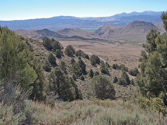
After a stop at the top of the pass, we start down the other side. We are now in the rain shadow of the mountains and the vegetation changes dramatically. There are trees in protected places, but most of the landscape opens up to high desert country. Going down is as steep or steeper than coming up, as is often the case on the east side of the Sierra.
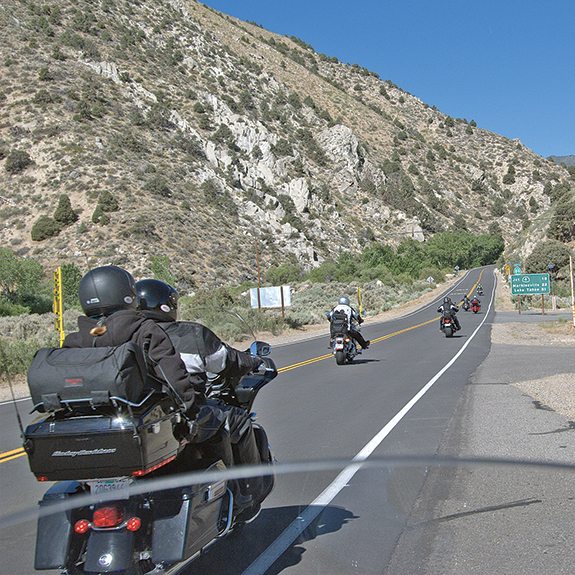
Past the headquarters of the Marine Corps Mountain Warfare Training Center, it is only a few miles to the junction with U.S. 395. Traveling north follows the West Walker River before opening out into the Antelope Valley, a surprisingly lush ranching area. To the east is the wall of the Sierra. It’s pretty spectacular if you’ve never seen it, and those who have will usually be back.
Our stopping place for the night is a Best Western hotel just over the Nevada line, next to the Topaz Lodge & Casino. After dinner at the casino, most of the group tries their luck at the tables for a while. We have a couple of winners by Sunday morning. The rest aren’t talking.
Sunday morning we have to backtrack about a half-dozen miles before we turn off on State Route 89, which will take us over Monitor Pass. This highway pass wasn’t completed until the early 1950s, when residents of Markleeville pushed to have a quicker way to get to U.S. 395 than going north nearly to Carson City.
Route 89 starts off climbing through some wonderful turns and twists through a creek canyon, with rock walls close on each side. After a few miles we are climbing along the side of a valley through dry ranching country. The climb up the pass is not as steep as yesterday or Ebbetts Pass to come, and the switchbacks are not as sharp, but there are plenty of them, making for a great motorcycle road. Coming up to the pass there are aspen stands which are green in summer, but can be spectacularly colorful if you come back in September or October before snow closes the pass for the winter.
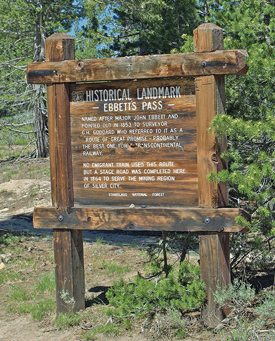
On the west side of the pass, the descent begins with some nice moderate to tight bends along with great vistas of the mountains. Before long we are twisting down another creek canyon. At the bottom we hit State Route 4, and turn left to follow the Carson River for a few miles. Jedediah Smith also made the first recorded crossing of Ebbetts Pass. In 1851, John Ebbetts traversed it with a large mule train, then later explored the pass as a possible railroad route, but found it unsuitable. A wagon road was eventually built over the pass with the discovery of silver in Nevada in 1862, which was used to transport goods from the gold rush town of Murphys to the Nevada mines.
After a few miles, the road leaves the Carson River and loses its centerline. It is steep and has serious switchbacks. Just before Ebbetts Pass, Kinney Reservoir makes a nice spot for a breather. Up and over Ebbetts Pass at 8,730 feet, it is downhill to alpine Hermit Valley before we climb again to Pacific Grade Summit. After more steep climbs and a couple switchbacks we reach the summit, and going down is on the gentle side.
After passing Lake Alpine, we are back on two-lane road again, going past the ski resort of Bear Valley. Route 4 is now a series of nice downhill sweepers all the way to Arnold, where we stop for gas and lunch. Hard to tell if the scenery is the best part, or the road. In either case, I’m having fun.
In Avery, we turn on Avery Sheep Ranch Road, and after about five miles of potholes on a one-lane goat trail, we hit Sheep Ranch. The rest of the way the road is smooth, with just a couple short one-lane sections. We are in the high foothills/low mountain country that not too many people know about, and cars are rare. The country is forested, with an occasional house or small ranch, including a bison ranch. Not the same scenery as the high mountains, but plenty to keep you interested.
After Rail Road Flat we pickup State Route 26, which meanders on our favorite kind of road past a bison ranch and goes to the town of West Point before ending at State Route 88, the road coming down from Carson Pass. It’s still too soon to be riding on roads that are any bigger, though, so in a few miles we take one last side road, Ridge Road, until reaching State Route 49 and turning north for home. Conquering a ride like this isn’t quite as tough as guys like Smith and Ebbetts had it, but it still feels like quite an accomplishment when it’s done!
(This Favorite Ride: California Pass-Bagging was published in the January 2015 issue of Rider magazine.)
 |
 |
 |
 |
 |
 |


 | Ep. 69 Rider Magazine Insider Podcast")


I’ve done most of this route on my motorcycle, and the whole thing several times in cars over the years. Spectacular scenery and great, twisty roads with good asphalt! Definitely recommended.
I was on this ride, thank you Rick for representing us with this writing. I have been riding for over 20 years, and this was without a doubt, the most spectacular trip I have ever taken on a motorcycle.