
If you want to travel from Salt Lake City, Utah, to Las Vegas, Nevada, by the shortest possible route, the 425 miles of Interstate 15 is about as close to a straight line as you can get. But, if how you get there is more important to you than when you get there, you have a few days to spare and you travel on two wheels, then there is a much better way to do it.
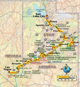
About four weeks and 3,400 miles into a North-to-South America motorcycle trip, my partner, Jessica, and I found ourselves pouring over our maps during dinner in Salt Lake City. Embracing the spirit of “how to get there instead of when,” the route we fixed upon would take us on a four-day arc, traversing Utah’s five national parks, Grand Staircase-Escalante National Monument and Lake Mead National Recreation Area, for what turned out to be the most spectacular riding of the entire North American leg of our trip.

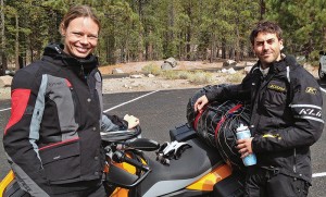
With the route traced on our map inside the clear plastic pocket of our Giant Loop tankbags, we set out the next morning at the leisurely hour of 9 a.m. It was necessary to follow I-15 south for about 50 miles. However, when the opportunity presented itself at Spanish Fork, we turned southeast onto the impressively named Grand Army of the Republic Highway, or U.S. Route 6. I always feel a renewed sense of freedom and possibility whenever I exit the Interstate onto a highway, but for Jessica it is a more tangible feeling of relief because she finds that her single-cylinder BMW G 650 GS begins to vibrate uncomfortably above 70 mph.
“It puts my butt to sleep,” she explained to me with a sheepish grin later during a midmorning break.
U.S. 6 took us on a meandering course through Spanish Fork and the Price Canyon Recreation Area. It was a pleasant segment on good tarmac through dry scrubland and past low hills, and a few stretches had gusts strong enough to explain the several wind turbines we saw. After Price, U.S. 6 merges with U.S. Route 191 and we took a sweeping arc southward through the flatlands east of the Book Cliffs—a 200-mile range that runs between Western Colorado and Eastern Utah. Farther south and about 20 miles after crossing the Green River, we left U.S. 6 behind and continued south into Moab.
In Moab, we found an oasis of restaurants and nightlife and fewer fellow motorcyclists than I expected in light of the excellent riding conditions. Originally settled by Mormon traders in the mid 19th century where the Old Spanish Trail crosses the Colorado River, the Moab of today is a mecca for climbers, hikers and off-roaders of all stripes. I was tempted to take the following day off and rent climbing gear or a mountain bike. But the next morning as we gunned passed several bicyclists slogging their way up the first switchbacks at the entrance to Arches National Park, I was blissfully content to have the 800cc of my BMW F 700 GS between my legs in the place of a chain, sprocket and revolving foot pedals.

riding Highway 89 south of Mapleton, but just be glad you have left the Interstate for more scenic travel.
It was early October and the federal government had shut down. Fortunately for the many visitors like us, Utah had made its own arrangements with the National Park Service. The smooth tarmac and sharp twisties of the scenic drive provided an excellent introduction to the park’s dazzling topography of eroded sandstone towers and more than 2,000 window-like arches. Several short hikes also brought us in contact with the famous Double Arch and Delicate Arch monuments featured in so many postcards and screensavers.
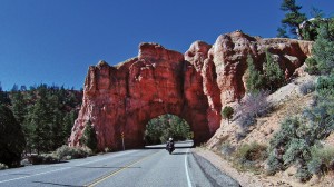
Around noon we headed back to Moab annoyed that we had neglected to pack for a viewpoint picnic. After a sandwich and soda, we retraced 10 miles of U.S. Route 191 and then turned south toward Canyonlands National Park. Entering the park, Grand View Point Road split off from State Route 313 and we began a 20-mile traverse of the wedge-shaped Island in the Sky, which is a mesa formed by and between the eroding forces of the Colorado and Green rivers about 2,000 spectacular feet below. That evening as we chatted over dinner in the town of Green River, about 60 miles back up U.S. 191, we decided that, where Arches was highlighted by stunning “monuments” and Canyonlands was a tour de force in grandiose views, the two rides were perfect complements.
The next morning, we left Green River going west on U.S. Route 50 and after about 12 miles we turned sharply southward. For about 65 miles, State Route 24 offered us scenic but not challenging riding as we clipped along east of the many fin-like rocky protrusions of the San Rafael Reef. For about 30 miles after Hanksville, the ride was distinctly more exciting as we threaded the narrows between the canyon cliffs and the Fremont River on our approach to Capitol Reef National Park.
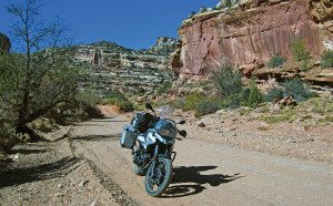
Although it is the least famous of Utah’s national parks, Capitol Reef, which takes its name from a sandstone formation that imaginatively evokes comparisons with the U.S. Capitol Building, carries the distinction of encompassing North America’s largest exposed fold of the Earth’s crust. This, combined with millions of years of deposition and erosion, sets the stage for an intricate, colorful terrain and a thoroughly entertaining motorcycle ride. Once inside the park, we followed the main road in a tour of several 19th century Mormon pioneer cabins and then we opened our throttles on the lightly trafficked Scenic Drive. It was 10 rough, potholed miles of dips, rises and hairpin turns during which we appreciated the durability and maneuverability of our dual-sports.
After Capitol Reef, we stopped in Torrey where, over lunch, we concluded that the Capitol Reef ride, which was into—rather than atop—the canyons, was less grandiose than Arches and Canyonlands, but was the most intimate riding experience so far. After lunch, we sped out of Torrey on State Route 12 already satisfied with the day’s ride. But we soon discovered that it had only been a warm up for the best 60-mile stretch of the trip.
First, we entered Dixie National Forest, the name of which is a tribute to the early settlers’ attempts to grow cotton in this mild climate region. Then we quickly ascended to above 9,000 feet as we skirted the eastern slopes of Boulder Mountain. Along with the precipitous drop in temperature, we encountered a spectacular and unrelenting series of curves through scenic forests of brush, snow and barren trees. Then, after leaving Dixie, we descended into the rolling, rocky hills and canyons of Grand Staircase-Escalante National Monument. The 30-mile ride through Grand Staircase to Escalante was yet another unbroken stretch of superb twisties accompanied by moderate temperatures and stunning views. The visual and sensorial climax came about eight miles into the national monument when we reached what the locals call the Hogsback. For us, this was a jawdropping half-mile of a veritable highway through the sky, as the mountain ridge fell precipitously away on both sides and there was only a ribbon of tarmac, distant canyons and clear blue sky.

That evening, we pulled into Escalante Outfitters in search of lodging, but a couple riding two-up on a Kawasaki KLR650 had rented the last cabin. So we rode up the street where, to Jessica’s delight, we found less rustic accommodations at the Prospector Inn.
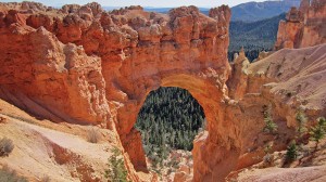
The next morning, we left Escalante on State Route 12, weaving through another 45 miles of meandering canyons until we reached the entrance to Bryce Canyon National Park. Thus far into the ride, breathtaking scenery was becoming almost commonplace; however, the 20-mile scenic drive through Bryce did not underwhelm. Full of expansive viewpoints, the most memorable for me was Inspiration Point, where hundreds of spire-like hoodoos fill massive natural amphitheaters like spectators attending a performance. Learning a lesson from Arches, this time we brought a sack lunch and picnicked at Natural Bridge viewpoint while an inquisitive four-wheeled visitor amiably interrogated us about our bikes, route and luggage setup.
After Bryce, we went south on U.S. Route 89 for about 40 miles and then west 10 miles into Zion National Park. With more than twice the number of visitors of Bryce (2.8 vs. 1.2 million, respectively), Zion is significantly more famous than its neighbor. With its incredible scenery, hairpin turns and mile-long stretch of Zion-Mount Carmel Tunnel that follows the inside curve of the canyon face and allows daylight to penetrate intermittently though arch-like windows, the 12 miles of State Route 9 that bisect the national park have all the makings for superb motorcycling. But ultimately the slow traffic and few opportunities to pass made it the least ride-friendly of Utah’s five national parks.
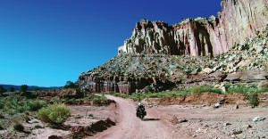
After Zion, it was about 20 miles to Hurricane and then a thrilling 30 miles through the Virgin River Gorge as Interstate 15 clipped the northwestern corner of Arizona before dumping us onto the desert plains of eastern Nevada. It was past sunset when we arrived in Mesquite, just over the Nevada border, and after a hot shower we collapsed into bed without even managing a visit to the blackjack tables.
The next morning, we enjoyed the final highlight of the Salt Lake to Las Vegas ride when we again detoured from I-15. We went south on Nevada Routes 169 and 167 into Lake Mead National Recreation Area. The Lake Mead NRA is 1.5 million acres of parched hill country through which the Colorado River once stretched its legs after emerging from the Grand Canyon, but is now bottlenecked by the Hoover Dam to form the country’s largest reservoir. Although the route lacked the magnificent views that we had almost taken for granted throughout southern Utah, the path it blazed was filled with just the right arc and interval of curves to make for some exhilarating motorcycling.

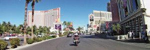
A visit to Hoover Dam would probably have been the fitting conclusion to the morning ride, but we were eager to reach Las Vegas, where friends and a rest day awaited us. As we entered the city, I thought about the phenomenal riding during the four days since Salt Lake, and was very happy we had planned the ride around how to get there instead of when.
(This article Salt Lake to Sin City was published in the October 2014 issue of Rider magazine.)



I have done those rides many times and now I have to do it again thanks to this column. Words just don’t do justice to the marvelous sights and of course the fantastic riding. For a rider who has more time there is a lot more excellent riding in the US west from the north rim of the Grand Canyon to Yellowstone.
I live on the east coast so maybe this time I will trailer the bike to Denver and ride from there. I-70 is ok but can get rally boring on a bike.
Nice column.
Thanks for the detailed and informative article! My wife and I just toured 2-up on my Vulcan 1600 Nomad from Saskatchewan (Canada) down to Phoenix and back, and we also fell in love with the constantly changing scenery, as we took highway 89 south from Provo past Bryce Canyon, Kanab, Marble Canyon, and the Grand Canyon. Our only regret was going in early September when it was still hot in the Phoenix area. There weren’t many bikes on the freeway (except us) when the temperature hit 104 degrees! On a future trip, we plan to check out some of the places you’ve described. Thanks again for the detailed route suggestions. It’s nice to hear about these places from fellow bikers who have already been there.
I loved the article Salt Lake to Sin City, the descriptions made me feel like I was there