What landform is found only in a small part of Iowa and in China? If you answered, “Huh?” you need to ride the Loess Hills National Scenic Byway on Iowa’s western border. You will enjoy a peaceful ride through hills up to 200 feet high.
Loess (pronounced luss) is fine-grained, loosely compacted silt laid down by the wind during the Ice Age. It can be found in many places, but in only two spots on earth to these heights.
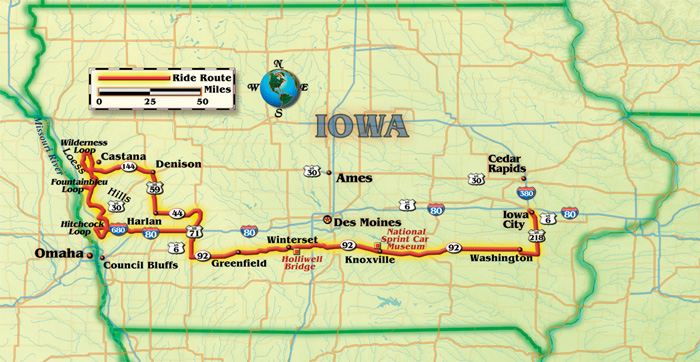
My husband, Mike, and I rode our Honda ST1300 south from Iowa City on U.S. Highway 218. We turned west onto Iowa Highway 92, a route that crosses the entire state and is south of and parallel to Interstate 80. At our first stop, we circled Washington’s town square with its benches and band shell to admire the ongoing restoration of ornate storefronts.
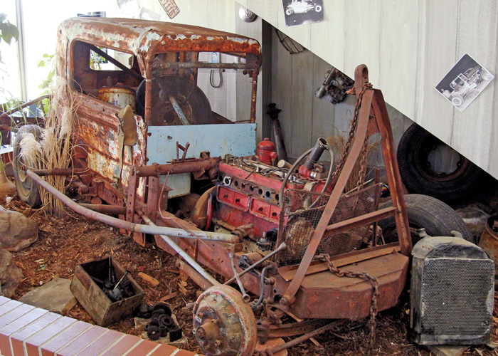
Highway 92 is smooth, straight and flat for many miles, bordered by rich Iowa farmland. In Knoxville, we stopped at the National Sprint Car Museum. Its first floor is filled with modern square-shaped sprint cars side-by-side with their early bullet-shaped counterparts. The second floor provides a complete view of the Knoxville Raceway next door. Races take place Saturday nights from April-September.
West again toward Greenfield, Highway 92 becomes bumpier and hillier with broad, sweeping curves. Newly planted crops continued the greening of Iowa in an unusually early spring. We smelled fresh, sweet, newly mown hay.
of Des Moines and not far off Interstate 80.
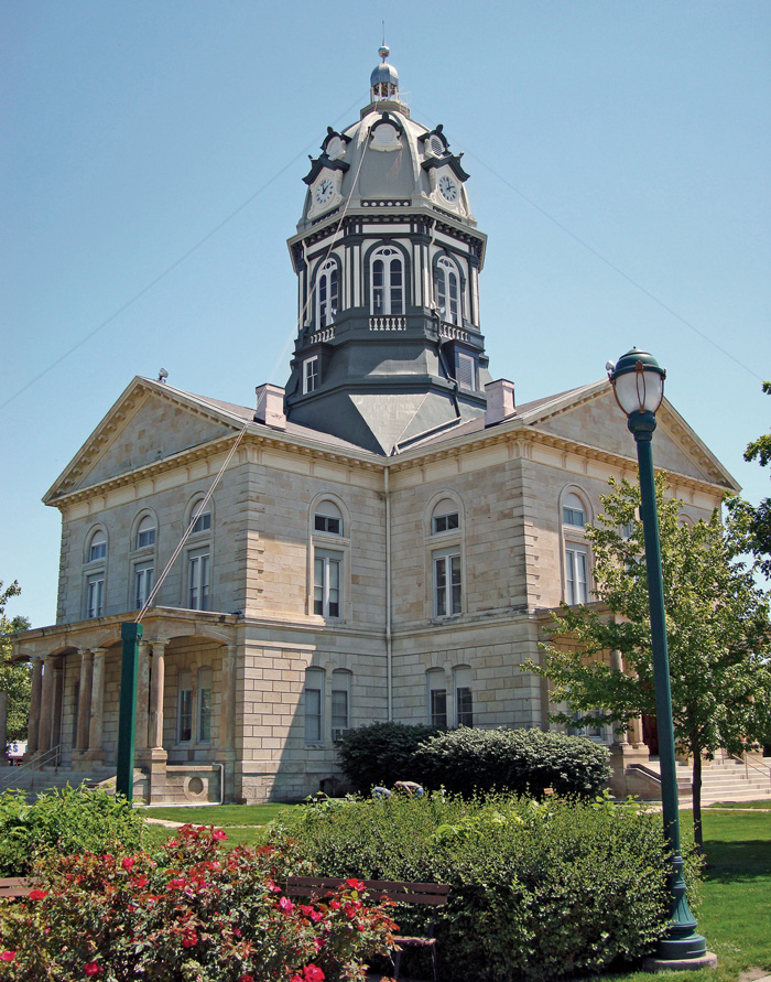
Our next break was Winterset, where its town square is occupied by the Madison County Courthouse. There are double-door entries on all four sides and a clock on each face of the large cupola on top—a study in symmetry.
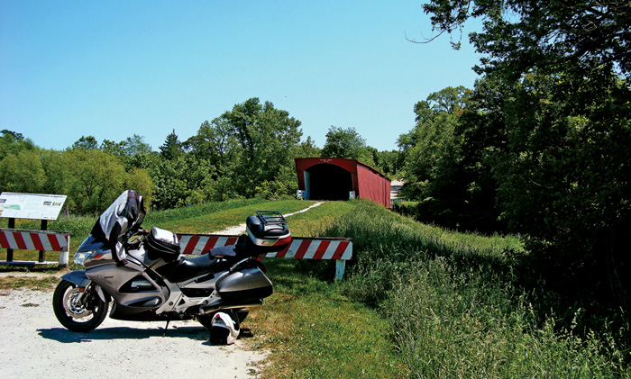
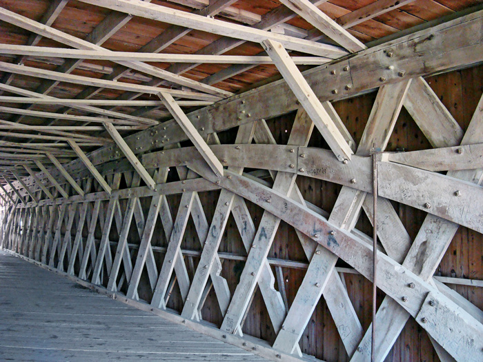
Winterset is known as John Wayne’s boyhood home, and for its covered bridges. We rode three miles outside of town on hard-packed gravel, raising a plume of dust behind. A short walk took us onto the bright red Holliwell Bridge, an impressive wooden structure. Built of 14-inch-wide timbers, it is 122 feet long and crosses the Middle River. Unique to this bridge are the end-to-end beams that form an arch across the entire length of each inner wall.
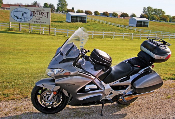
Back again on Highway 92, the sky was cloudless, the wind light and the temperature ideal. We soon headed north on U.S. Highway 71, then west on State Route 44 to Harlan where we stopped for the night.
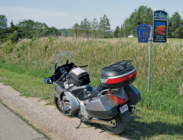
In the morning, strong winds swept across the Great Plains, a common occurrence. We headed northwest to Castana where we joined the Loess Hills National Scenic Byway. From this point on, the only way to find the route on obscure county roads is by using the printable maps found in the byway guidebook. It is available online at visitloesshills.com.
We decided to explore the Wilderness Loop even though the guidebook states, “You will travel on paved and gravel roads on this 13-mile loop.” It’s pretty much all gravel, and gravel on loess results in a slushy, shifting road surface. The road rises and falls steeply, with sharp turns. We slipped and slid our way back to asphalt, agreeing to no more gravel roads in this area.
Following the soothing, flat surface of the Byway Spine, we hopped off at the Fountainbleu Loop and took a meandering asphalt road for nine miles to the Murray Hill Scenic Overlook. The guidebook says, “Hike up a hill through prairie grasses for better views…” The view seemed good from the parking lot, but then we noticed the sliver of a path waaaay up that steep, prairie grass-covered hill. After hiking to the second of three points, we decided the Missouri River Valley was breathtaking enough from there, pun intended. It looked like gravel farther on, so we backtracked to the Byway Spine.
Cruising the hills around gentle curves, we met only an occasional vehicle. What a sight this must have been when it was blanketed with prairie grass and flowers. Now trees have invaded the habitat. It’s scenic and tranquil, but it isn’t wild prairie. Along the way, erosion exposes the fragile nature of loess.
Still heading south, we joined the Hitchcock Loop hoping for hard surfaces. We were in luck. The Hitchcock Nature Center was the best stop of the day. Besides the interpretive center, there is a 45-foot observation tower. It offers a 360-degree view of the Loess Hills and Missouri River Valley. A powerful telescope perches on the top deck—no quarters required. We picked out farmsteads, distant roads and a ribbon of the Missouri River. We were the only ones there. No sounds of traffic, no planes coming in for a landing. Just birds serenading each other and leaves whispering in the wind.
This part of the Byway is like a step back in time. There were nothing but small towns along the route, and long stretches of just us, the bike, the road and emerald-green hills. The entire Byway Spine is about 200 miles long, from north of Sioux City, Iowa, to near St. Joseph, Missouri. Counting our loop diversions, we had traveled only 130 miles. Beginning our search for lodging, we avoided heavily populated Omaha-Council Bluffs and turned to the east.
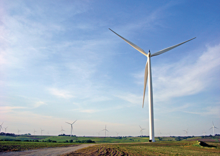
Between Avoca and Atlantic, large wind farms sprout along hilltops. In 2011, Iowa ranked second only to Texas in wind-generated megawatts of capacity. The unobstructed winds that rotate the massive turbines also turned this ride into a challenge.
We overnighted in Atlantic, finding an excellent restaurant within walking distance of our non-descript motel. The Feed Lot Steakhouse is a small establishment garnering rave reviews from the Des Moines Register. Prime rib, their specialty, looked awfully good at neighboring tables, but we would need doggie bags and had no cooler. Instead, we can recommend the fried jumbo shrimp and chicken-fried steak.
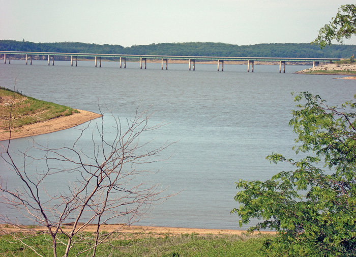
Heading home the next morning, we took a short side trip north near Knoxville to scope out Lake Red Rock. We crossed the mile-long bridge spanning part of its 15,000 acres. Besides camping spaces, there are seven modern cabins available. Back on Highway 92 we rode east, trying to maintain within us the serenity of the Loess Hills. It’s like nothing else in Iowa or any other place in the United States, for that matter. And best of all, it saved us a trip to China.
For more information:
visitloesshills.com
Provides detailed route maps for the byway and lots of information about the numerous sights along the way.
sprintcarhof.com
Has details about the Sprint Car Hall of Fame and Museum.
madisoncounty.com
Directs you to information about the covered bridges.
redrockarea.com
Describes the Red Rock area and leads to cabin rental rates and availability.
pottcoconservation.com
Features the Hitchcock Nature Center and other parks in the area.
(This Favorite Ride article Iowa’s Unique Scenic Byway was published in the June 2013 issue of Rider magazine.)
 |
 |
 |
 |


 | Ep. 69 Rider Magazine Insider Podcast")

