The following is an excerpt from the article Of Ribs and Roads: Barbecue and Byways in the Carolina Mountains printed in the June 2004 issue.
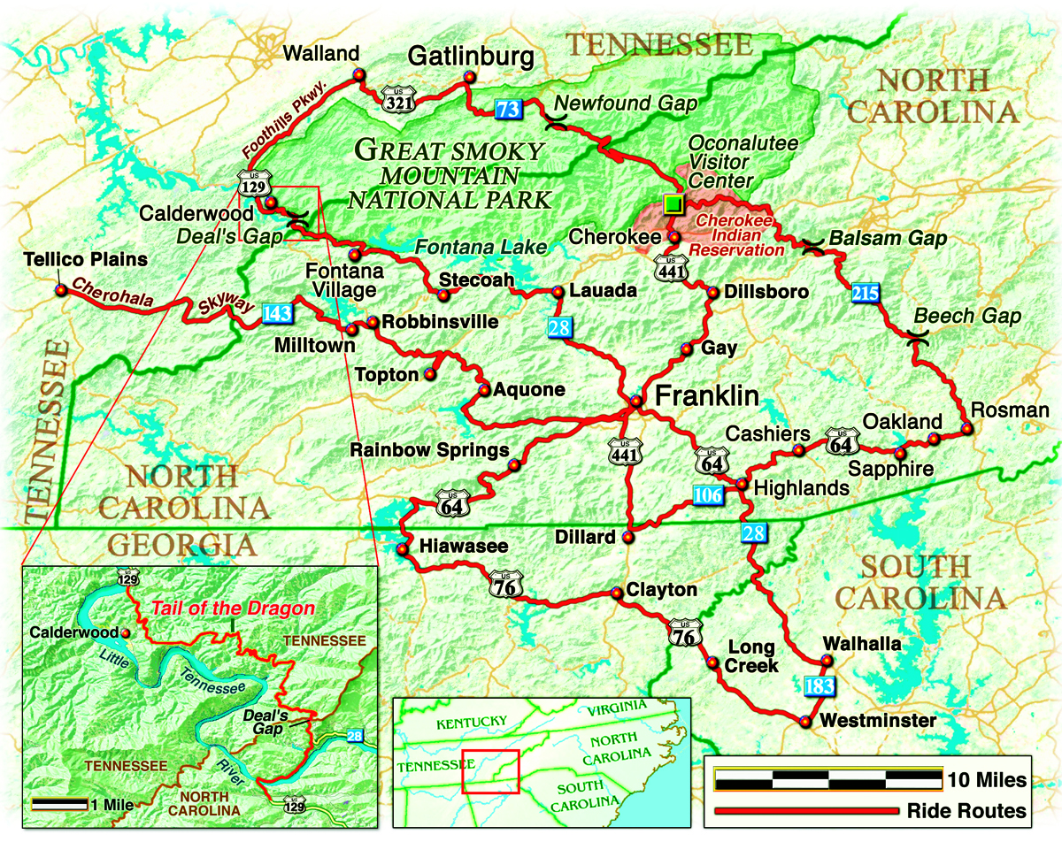
Franklin, North Carolina (population 3,800) is the self-described Gem Capital of the World, owing to the rubies and sapphires found in the area’s mountainside mines. Precious stones not your thing? There are gems for motorcyclists, too. Snaking over, around and sometimes through the mountains surrounding Franklin are asphalt shrines to civil engineering. You won’t find better riding in the East.
- The intense curves of North Carolina Route 28 lead to Highlands, a well-to-do hill town with arty shops, galleries and restaurants. For good eats, Hilltop Grill serves a barbecue sandwich with a local twist: Sharing the roll with my beloved barbecue pork was a layer of cole slaw. Very tasty.
-
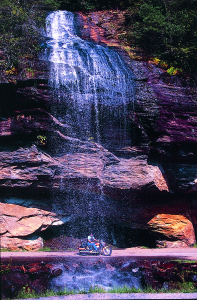
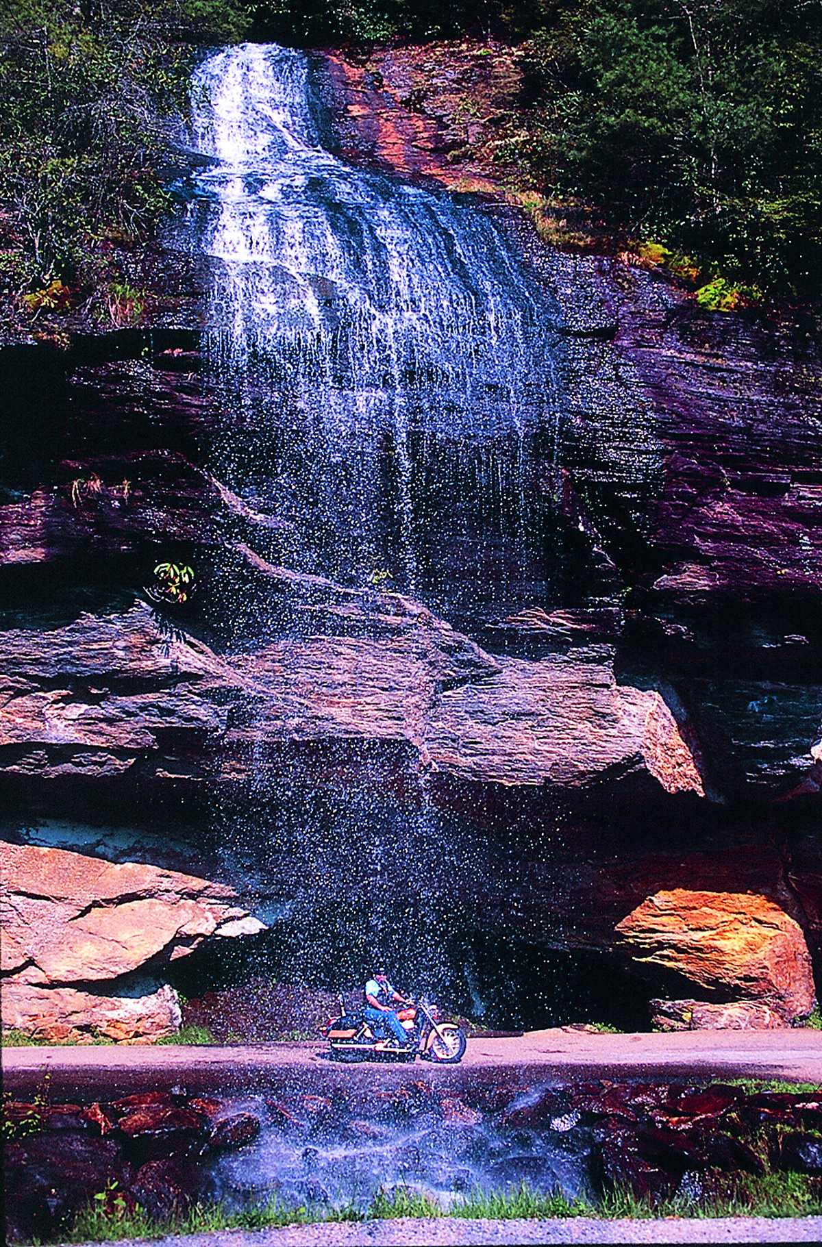
Western North Carolina boasts the highest concentration of waterfalls
anywhere in North America. At Bridal Veil Falls, you drive behind the cascade.Western North Carolina boasts the highest concentration of waterfalls anywhere in North America. At Bridal Veil Falls (State Route 28 north of Highlands), you drive behind the cascade. Then, just beyond Oakland on U.S. 64, Toxaway Falls roars under the road and down the rocks.
- Enter the Blue Ridge Parkway near Beech Gap and head west along the Parkway’s highest elevation. The easy turns along the ridge strike a contrast with the hairpin turns that brought us to the ridge. The Parkway’s terminus delivers us to Great Smoky Mountains National Park.
- Venture north of Franklin on Route 28 into the Nantahala National Forest. The curves range from tight to treacherous and the views are magnificent.
- Just west of Franklin, turn right off U.S. 64 at Mount Hope Baptist Church, then left at Loafer’s Glory onto Wayah Road. This road slices through woods and hills along the Nantahala River with a wide selection of captivating waterfalls to photograph. Also known as UPS Curve, Wayah Road is a twisting ribbon better suited to motorcycles than parcel-toting trucks.
- Follow Route 143 west of Robbinsville to the Cherohala Skyway, which crosses the border to Telico Plains, Tennessee. After 38 years of planning and construction, the Skyway was completed in 1996 and it just may be the best hundred-million tax dollars ever squandered on pavement. It’s 40 miles of esses through wilderness with no stretch that could be labeled a straightaway.
-
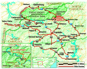
MAP BY BILL TIPTON/COMPARTMAPS.COM Tail of the Dragon: The popular Tail of the Dragon begins in the tiny town of Deal’s Gap in North Carolina and crosses into Tennessee. A number of motorcycles attack an 11-mile stretch of U.S. 129, known as the Dragon, daily. Across the border, the tar is flawless and the curves bank perfectly. There’s no shoulder, no guardrail and no margin for error. Missing one of the 318 curves drops you into no man’s land, somewhere between ditch and ravine. This is called fun.
Author Scott A. Williams maintains an online blog at motobones.net
For a PDF of this article from the April 2013 issue, CLICK HERE.
To read the full text of the original article from the June 2004 issue, CLICK HERE.


 | Ep. 69 Rider Magazine Insider Podcast")

