The high mountain passes of the Rocky Mountains are an incomparable motorcycle touring experience, ringing with the legacy of tens of thousands of gold prospectors who fearlessly blazed trails across them in search of riches.
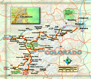
In 1858, the discovery of gold near Pikes Peak triggered the biggest gold rush in history, as more than a hundred-thousand prospectors scoured the Rocky Mountains seeking to strike it rich. These intrepid souls carved trails through the mountain passes that were followed by railroads to transport the ore to market. Today these remarkable trails and railroad beds are an unparalleled network of roads that are riding heaven. For four days, my wife Sandy on her Honda VTX1300, my brother Ken on his VTX1800, my nephew on his Suzuki SV650, and I rode these superlative roads to explore the gold mining roots of Colorado.
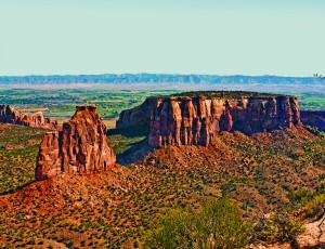
It was a beautifully clear summer day when we began our journey through the extraordinary Colorado National Monument, which abuts the southern border of Grand Junction. There was very little traffic as we wound our way up the twisty Rimrock Drive, with spectacular views of the Uncompahgre Plateau over 2,000 feet below.
Designated as a National Monument in 1911, the park preserves spectacular canyons cut deep into sandstone and granite by eons of relentless erosion, creating fascinating rock formations and sheer-walled, red rock monoliths and buttes. The 23-mile Rimrock Drive navigates the length of the Monument, offering breathtakingly vast plateau-and-canyon panoramic views of the steep Book Cliffs in the distance. These form the western slope of the Rocky Mountains across the Grand Valley, with the Colorado River snaking its way westward. The ride down the eastern escarpment provided a thrilling opportunity to hone our braking and gear-management skills as we negotiated steep, tight curves with sheer drop-offs.
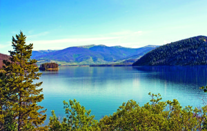
Our gateway into mining country was the Grand Mesa, which has the distinction of being the largest one in the world, rising over 5,000 feet above the surrounding valleys and covering over 500 square miles. The road climbs steeply here, and the terrain and climate begin to change dramatically from the hot, arid valley to lush forests and lakes, with chilly temperatures that necessitated a brief stop to add a couple of layers of clothing. At the Grand Mesa’s highest point, the GPS displayed an elevation of 10,800 feet! The sky was dark blue and the air was crisp, infused with the aromatic scent of the impossibly tall pine trees that towered above us. They are Engelmann spruce, which thrive in high-altitude alpine regions and can grow to almost 200 feet in height. This slow-growing hardwood apparently has unique characteristics that make it popular for acoustic guitars.
The steep, twisty ride down the mesa’s escarpment on CO 65 and CO 92 took us to the Black Canyon of the Gunnison National Park. One of the country’s newest national parks, it was initially designated a national monument in 1933 and elevated to national park status in 1999. Formed by the Gunnison River, the Black Canyon has the highest sheer cliffs in Colorado at 2,250 feet, comprised of extremely hard crystalline rock. The canyon obtains its name because it is so narrow and deep that sunlight rarely reaches some parts of the canyon floor.
The Gunnison River roars through the canyon at an incredible rate, dropping an average of 96 feet per mile, including a jaw-dropping 480 feet in one two-mile stretch. The air vibrates with the low thrum of the rampaging river. The Black Canyon is considered the ultimate technical whitewater kayaking challenge, with numerous dangerous Class V rapids. The park is also a mecca for traditional mountain climbers who are attracted to the sheer rock walls.
After spending the night in the nearby town of Montrose, we awakened to another gorgeous morning with clear blue skies and scattered soft cumulus clouds. Our first stop was the silver and gold mining town of Telluride, although known today more for its trendy ski resort than its mining heritage. This picturesque historic town maintains its mining frontier-town aura amidst gourmet cafés and shops. The surrounding snowcapped Telluride peaks and aspen forests provide a beautiful setting for a midmorning coffee break.
Continuing south, we passed through the town of Durango and turned north onto U.S. 550, also known as the Million Dollar Highway, into the center of the Colorado mining region and the San Juan Mountains. The picturesque high-altitude mountain town of Silverton is a former silver mining camp established in the 1870s. While the mines have long since been depleted, the town’s historic district is a popular tourist destination.
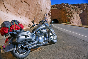
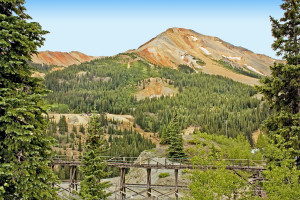
A few miles farther on the extraterrestrial-looking Red Mountains appear, named for the bright orange streaks on the mountainside caused by the iron ore in the soil. Within this 30-mile area there are over a hundred abandoned mines that yielded tons of gold, silver, iron, copper and other metals from the 1870s until the last mine shut down in 1978. We could see the remnants of the Yankee Girl Mine, which was already one of the highest producing silver mines ever when a massive pipe of nearly pure silver was discovered in 1882. The pipe extended over 1,200 feet into the ground and took 16 years to extract. The silver was valued at over $100 million in today’s dollars.
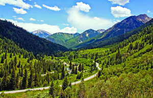
We continued our trek north on U.S. 550, winding through the rugged San Juan Mountains on this incredibly twisty, scenic road surrounded by dense forests, with periodic waterfalls cascading off the mountainsides. We rode through the historic mining towns of Ouray and Ridgway and emerged from this wooded wonderland onto an arid plateau as we approached the Curecanti National Recreation Area, formed from three reservoirs created by dams along the Gunnison River. These fjord-like reservoirs are surrounded by a stark landscape of panoramic mesas cut by deep, narrow canyons.
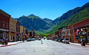
We spent the night in Gunnison, where Wyatt Earp and Texas Jack settled for a few years following the infamous gunfight at the O.K. Corral in Tucson, Arizona, in 1881. Earp eventually went on from the Klondike Gold Rush in Alaska to become a fixture in Hollywood. In fact, in the 1920s, near the end of his life, he befriended a young prop boy and stuntman who took on the persona of Earp’s wild-west machismo before changing his name to John Wayne.
We rode west along the north side of the Black Canyon through large cattle and bison ranches surrounded by low mesas that front the West Elk Mountains. Our motorcycles glided through twists and curves on the beautifully engineered CO 133. After gaining over 3,400 feet of elevation via some magnificent twisties, we reached McClure Pass. The road down from the pass is steep and windy before it levels out and travels north alongside the Crystal River.
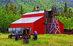
On CO 82, we rode alongside the Roaring Fork River toward the silver mining town turned glitzy ski resort of Aspen. The town is a haven for the rich and famous, apparent by the extravagant homes and proliferation of exotic cars. We rode through the crowded streets as quickly as possible and fled into the magnificent scenery of the Sawatch Mountain Range. The road twists and curves as we gained over 4,000 feet of elevation. As the temperature dropped, we stopped to add a couple of layers for warmth before continuing toward Independence Pass on the Continental Divide. The road transitions from twisties into tight switchbacks with a steep, 6.5-percent grade as we rose above the tree line into tundra. At 12,095 feet, Independence Pass is the second-highest paved mountain pass in Colorado and is open for only a few months of the year. The road is so steep that trucks and other large vehicles are prohibited.
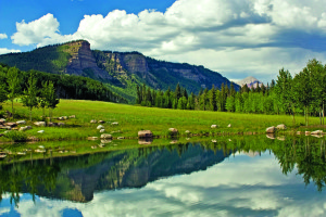
From the pass we had panoramic views of the Rocky Mountains, including Mt. Elbert, the highest peak in the Rockies at 14,440 feet. The pass summit is dotted with small alpine lakes and tundra streaked with snow. The temperature hovered just above freezing with a strong, gusty wind as stormy weather overtook us. The distant peaks became shrouded in clouds and the rain turned to sleet; when lightning flashed in the clouds and the air vibrated with deep rolling thunder, we decided to head down into the silver mining town of Frisco for the night.
The next morning, the weather had transformed from cold and stormy to beautiful clear-blue skies. We got an early start, and the temperature was cool in the high Rockies where we were surrounded by imposing mountain peaks. We rode out of Frisco south on CO 9 along the Dillon Reservoir perimeter and through the ski resort town of Breckenridge. Although a trendy ski resort town today, Breckenridge was a hotbed of gold mining activity during the Pikes Peak Gold Rush from 1859 through the turn of the century.
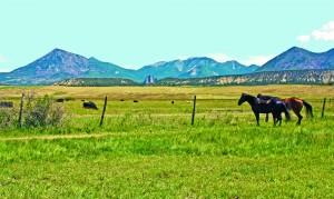
Tight switchbacks and an 8-percent grade created a thrilling and challenging ride as we gained over 2,500 feet of elevation to Hoosier Pass at 11,542 feet. We had terrific views of the Tenmile Range to the west as we rode south along the Mosquito Mountain Range into the historic town of Fairplay. Founded in 1859 in the early days of the Pikes Peak Gold Rush, Fairplay is on the northern border of South Park, an enormous thousand-square-mile grassland basin. Fairplay was made mildly famous as the town depicted in the animated television series South Park. One of the co-creators of the series grew up in the nearby town of Conifer and used a number of area locations in the show.
On U.S. 285, we rode across the flat terrain of the South Park Basin through vast cattle ranches, with the high peaks of the Front Range from horizon to horizon. We reached the east side of the basin and the road gently rose in long sweeping curves up to Kenosha Pass at 9,997 feet, where we finished a great ride through the heart of Colorado Rockies mining country.
(This Rocky Mountain Gold Rush article was published in the October 2012 issue of Rider magazine.)
 |
 |


