When I last visited my friends Brian and Pam Rafferty in Sioux Falls, South Dakota, to develop an article (Connecting the Dakotas, Rider, August 2009), they weren’t of a mind to leave one of America’s most livable cities. Well, the economic travails of the times dictated that they pull up stakes and follow a job prospect in Yakima, Washington, a place once honored with an All-American City Award. They are now contentedly settled within sight of both Mt. Adams and Mt. Rainier.
My hosts proceeded to show me Yakima’s downtown historic district, a section of brick streets and cast-iron lamp posts. One plaque informed me that Bert Grant started the nation’s first brewpub in 1982 inside the old opera house, appropriate since Yakima Valley produces 75 percent of the hops grown in the United States. What’s ironic is that despite the prevalence of hops, Yakima boasts only one remaining brewpub, the Yakima Brewing Company. In reality, it’s just a taproom, but we indulged in a pint or two in remembrance of old Scot Mr. Grant, who, alas, has since passed on to his hoppy reward.
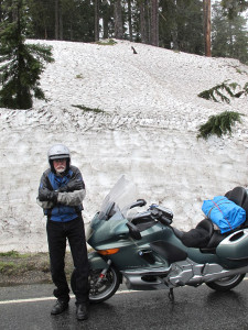
I intended to ride three loops surrounding Yakima to see what else it had to offer. Mt. Rainier beckoned, but my first attempt met with a 45-degree temperature and drizzle. Deep snowdrifts blanketed either side of the road in this latter part of June. Brian said this towering, freestanding mountain creates its own weather. On a day with better prospects, Brian showed me the way out of town along Summitview Road, so-called because soon Mt. Adams presents its ghostly form some 50 miles distant.
Summitview glided down an escarpment providing a view of vineyards and orchards in the valley town of Naches. Not only are more than 40 varieties of fruit and produce grown in the region, Yakima Valley has become one of the largest wine-producing sites in the nation. I pick up State Route 410 to follow the Naches River until a detour because of a landslide that has permanently closed the road ahead. At the Wood Shed Restaurant, I divert onto Niles Valley Road, a splendid ride through the countryside until rejoining Route 410 at appropriately name Cliffdell.
I breeze past Whistlin’ Jack Lodge, whose large stone fireplace warmed me the previous day during my inclement weather run. Soon Route 410 becomes more interesting as it elevates to Chinook Pass alongside a huge chasm punctuated by cleft peaks, and then barrels through the snowdrifts until Mt. Rainier suddenly rears in total splendor. I branch off onto Route 123 south and pass by numerous waterfalls cascading off the cliffsides.
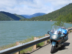
The road to Paradise is 22 miles of alpine delight until the shoulder of mighty Rainier is encountered. After a repast at the restaurant and a frolic on the ice, I glide the BMW back to the main highway, picking up White Pass U.S. Route 12 past gleaming Rimrock Lake and alongside the Tieton River. Both the Tieton and Naches Rivers fork at the junction of U.S. 12 and Route 410 beneath basalt cliffs, forming an impressive view.
I am discovering a geological wonderland where these eastern slopes of the Cascade Mountains meet the high desert plateau of Washington. The Cascade Range, born of fire and ice, forms a distinct climatic border between the wetter western and drier eastern portions of the Pacific Northeast. Unfolding eastward from this division in topography are magnificent pine forests and rugged mountain terrain interrupted by seas of rangeland, lava, pumice, sagebrush, scabland, basalt rim rock, coulees, buttes and craters.
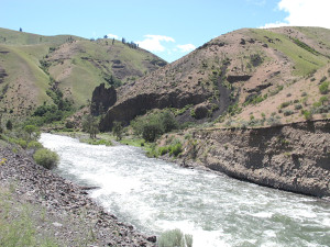
My second loop out of Yakima takes me along State Route 821 through Yakima Canyon that slices between basalt cliffs forming a steep narrow gorge. Yakima River erosion caused the uplift along what once formed one of the largest lava fields in the world. Through the college town of Ellensburg, I jump on U.S. 97 toward Swauk Pass. This begins the Stevens Pass Greenway, part of the Cascade Loop. I lope beneath wind turbines taller than the Statue of Liberty; the turbine blades alone measure 129 feet in length. At Swauk Pass lie the remnants of the 1860s gold-mining town named Blewett.
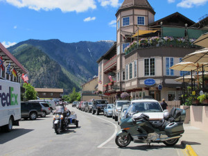
Drifting off the pass brings me to the Bavarian-themed village of Leavenworth. The town is situated in an alpine setting not unlike Telluride, Colorado. The place is adrift with tourists, with nary a place to park, unless you’re on a motorcycle. Oktoberfest celebrations are the norm. I chose a sausage garten and gnawed on a sauerkraut and mustard-laden kielbasa. Then I hit the road for a circuit around the Wenatchee wilderness.
After a return to Leavenworth, I pick up U.S. 97 to the Columbia River. U.S. 97 follows an earthquake fault high above the river beneath lava-filled fissures of cliffside rock. I pierce a tunnel and end up at Lake Chelan, a 55-mile-long tongue of pristine, glacial-formed liquid gleaming with clarity from a 1,486-foot depth. Only excursion boats are allowed the length of Chelan to the isolated town of Stehekin.
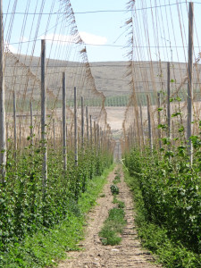
Dropping south on the east side of the Columbia on State Route 151 takes me past acres of cherry trees and apple orchards. This side is markedly drier, and the Columbia forms a clear delineation between the Cascade wilderness and the eastern land of coulees. Unlike the Grand Coulee upriver, smaller dams along this route further apply the tourniquet. Heavy traffic ensues for some reason at East Wenatchee. More wind turbines appear across the river. Route 281 south of Quincy runs through agricultural cropland, and I notice the number of Mexican restaurants suddenly mushroom. Flora is preserved in lava flows as petrified trees near Vantage. My final route to Yakima over State Route 24 takes me through the hop fields. Wire trellises extend up and out like a cubical spider web. At full maturity, the hop plants will reach a height between 15 and 18 feet.
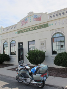
Southward I now go on U.S. 97 to Toppenish for loop three. This town was named one of the 20 best places to live in the West by a cowboy magazine. Hispanic influence is prevalent, although the Yakima Nation Cultural Center is located here to celebrate the true first residents of the region. The town is nothing if not colorful, with more than 70 historically accurate murals sprucing up old brick buildings. But more importantly, Toppenish is noted for its American Hop Museum, the nation’s only one. Hops have been used for centuries to preserve and flavor beer, and herein is the entire history of this perennial vine of the Cannabis family. Located across the street is the 1911 Northern Pacific Railway Depot Museum.
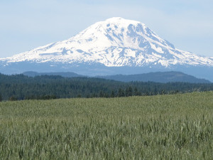
It’s 50 miles between Toppenish and Goldeneagle on U.S. 97. The geography is stark, but corrugated, even humping over a low pass with a nearby ski area. At Goldeneagle, I head west on State Route 142 through grassy rangeland until startled by the sudden appearance of Mt. Adams displaying its snowy crown in full glory. The route then zigzaggs through a canyon alongside the Klickitat River, a popular motorcycling route given the number of riders I raised an index finger to; I was otherwise too busy clutching. Altogether, Route 142 is a 34-mile curvaceous delight until its connection with State Route 14 above the banks of the Columbia River.
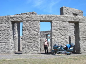
I headed east back to U.S 97, where I encountered the Maryhill Museum of Art, a castle-like chateau built for Pacific Northwest entrepreneur Sam Hill overlooking the Columbia River Gorge. Fertile ranchlands surround the museum where Lewis and Clark once trod. Picnic grounds amid the native plants and a sculpture garden complete the landscaping. Down the road is Sam Hill’s Stonehenge Memorial, a somewhat fanciful replica of the Neolithic English site that he had built as a World War I remembrance.
The first signpost I saw leaving Stonehenge indicated, “Next Gas 85 miles.” I did see a convenience store in Roosevelt, but not much else. No option other than to follow the dramatic course of the mighty Columbia to Kennewick and the Tri-Cities area. The others include Pasco and Richland. At one time, Forbes Magazine named Kennewick the number two area in the U.S. for job growth. Number one was…Yakima! The reasons for these ratings include agriculture, the Hanford Nuclear Site and the Pacific Northwest Laboratory, which conducts some sort of counter-terrorism activities. The irony is, the Raffertys used to live here.
U.S. 12 leads me out of the technology sector and into viticulture at Prosser, a community with more than 25 wine-tasting rooms. State Route 22 swings back toward Toppenish through surrounding vineyards and orchards along the Yakima River. Wineries and produce stands continue in profusion at Zillah, which displays a bit of roadside Americana with its giant teapot dome. Check it out!
My cloverleaf complete, I can only hope the Raffertys don’t move again; it’s an effort following them around the country!
(This article is a Web Exclusive and was not publised in the print edition of Rider magazine.)
 |
 |


One of my favorite rides, I like it best around September as the weather is usually good.
Good article !
Yakima is the center of the motorcycling universe as far as I am concerned. Six mountain passes within 100 miles, great country roads within ten minutes of town, lots of great folks. We moved to Florida in January of this year after spending sixteen years in Yakima and not a day goes by that I don’t think about, the mountains and roads around Yakima.
I really like Rider’s descriptions of rides, long and short. They are one of the big reasons I have subscribed to Rider for nearly twenty years. I use them to plan long summer trips for myself. The maps are especially useful. Could you include a map or map link with articles like this for those of us who dream of following the author’s path?
Good article! I have been on most of these rides and must agree completely with Mr. Paulsen’s assessments. I live in Yakima and the sites for each of these rides change with each season. I have not been on all the “loops”, because a couple of them are favorites and deserve encore rides every separate season. The Wood Shed Restaurant is a popular watering hole for motorcyclists and the people are very friendly and inviting. They often have live bands in the summer time on the back porch facing the river. Just be sure you watch out for deer and elk on any Cascade Mountain Range road. They are interesting to watch, but you don’t want to tangle with one on your bike! They always win!
Gotta love the Pacific Northwest, especially the dry side!