story and photography by Clement Salvadori
Which way to the Pembina Gorge?” I asked the only person I saw on the sidewalk.
“Go back to the highway,” he said, “take a left, and keep right at the moose.”
“Keep right at the moose?” I asked quizzically.
“Don’t worry, you’ll understand,” he responded.
Which I soon did, as I came upon a small triangle of grass in the middle of a fork in the road, and standing there were two moose (meese?)—life-size statues.
This was in the town of Walhalla, up there in the very northeastern corner of North Dakota. I was rolling the slow way back to California, riding back just south of the 49th parallel. The 49th constitutes much of the border between the United States and Canada, going from Boundary Bay on the Pacific Coast to Lake of the Woods in Minnesota, straight as an arrow, so to speak, for 1,700 miles, taking into account the curvature of the earth.
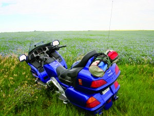
Sue and I had ridden two-up on a Honda GL1800 Gold Wing to Lancaster, Minnesota, a little town tucked in the northwest corner of that state, in order to join in a reunion for her father’s side of the family. Some 300 Olsonoskis and kin had shown up. Sue was going to spend a couple of weeks with her dad, and then fly back, and I was riding home alone. Having always wanted to see the International Peace Garden on the U.S.-Canadian border in North Dakota, this was the opportunity.
After giving my father-in-law, a retired dairy farmer, a hug, and telling him to take good care of his youngest daughter, I headed out of his half-section of woodland and field. Midwestern farmers know about sections, but for you urban types, a section is a square mile, or 740 acres, which is the way this homesteaded land was divvied up by the government a hundred years ago. Such sizes are pretty unimaginable to people who live on an 80- x 100-foot plot in Los Angeles. I got on U.S. 75, and half an hour later I was crossing the Red River of the North and entering North Dakota.
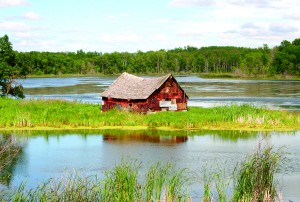
The first building I saw in Pembina was a small state-run museum, with 100 million years of local history on display, from Mesozoic-era geology, to the Native American civilizations of pre-Columbian times, to modern day. A trip up the museum’s seven-story tower gave me a splendid view in all directions, at least half of them in Canada. There are 14 border crossings between North Dakota and Canada, three of them open 24/7 including the one in Pembina—the others run a more cost-efficient 9 a.m. to 10 p.m. schedule. The crossings used to be pretty informal, but since 9/11, the borders have tightened up.
I asked about places to see, and the genial person at the museum desk recommended I head due west to Walhalla and take in the magnificent Pembina Gorge. As I rolled out of town on a two-lane road, I had visions of a gigantic cleft in the earth, equaled only by the Grand Canyon. The first 30 miles were pretty much ruler straight across many flooded fields; it had been a very wet spring. A couple of roads went off at right angles, all having to do with that “section” notion. Those homesteaders got a square mile based on an east/west azimuth, and roads went along the property lines, which is why rural Dakota roads usually don’t have any gentle curves. I came to a stop sign, turned left on ND 32, and was soon at the moose intersection. The countryside was changing to low rolling hills as I headed toward the Walhalla Country Club, with a nine-hole golf course. At the Club the pavement ran out, but I could see that the dirt road was getting prepared for asphalting. Soon I could look down into the Pembina Gorge, which, regrettably, was not quite as dramatic as I had hoped. The Pembina River, coming out of Canada, was cheerfully gurgling along between the gently sloping hills, over 12,000 acres of woodland, and the road dropped down maybe 500 feet, crossed over on a bridge and then climbed up the other side. Maybe this was not quite the Grand Canyon of the North, but it certainly served to do away with anyone’s notion that crossing North Dakota is a flat and boring operation.
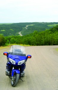
According to the tourist brochures, this road is called the Rendezvous Region Backway, as in this area the European fur-trappers rendezvoused some 200 years ago, meeting with the Chippewa and other Indian tribes. The Hudson Bay Company had a trading post there in 1803. That all changed with the building of the railroads after the Civil War, and immigrants coming from Poland and Scandinavia found a landscape that reminded them of home. Sue’s granddad had homesteaded his original piece of land in 1900, and fathered 15 children, who were useful in helping him work the place. These new arrivals populated the flatlands and farming became the work of choice and has continued to this day.
After the gorge I dropped down to Langdon, seat of Cavalier county, on ND 5; that Route 5 is the northernmost east/west through-road in North Dakota, 335 miles of two-lane bucolicism. Some misinformed folk think the U.S. 2, some 40 miles to the south, is the way to cross the Peace Garden State. But that is a seriously dull way to go, as it is mostly a four-lane divided highway. Stick to ND 5 is my recommendation. On our way to the reunion, Sue and I had taken the eastern end of ND 5 briefly to get across the Red River and on to Lancaster.
The Langdon town motto is “Standing proud on the prairie,” so I was presuming that I was out of the woodland and on to the open land. The farm-equipment dealers had endless rows of tractors, ploughs and harvesters, reminders that farming has become an occupation that requires a lot of expensive machinery and a good line of credit. Branches of the Burlington, Northern & Santa Fe Railroad went off to all the little towns, picking up quantities of wheat, durum, oats and other crops; trackside silos are to be seen all along the way.
I was going west on ND 5, occasionally making a right-angle jog to keep with those sections, yellow fields of canola flowers bordering blue fields of flax and green fields of young wheat—very pretty. A roadside plaque celebrated the arrival of the Finnish immigrants in this part of their New World. I arrived in Rolla, seat of Rolette county and jumping-off place for the International Peace Garden. Angling up through St. John I came out on the Turtle Mountain Byway, a languorous stretch of asphalt that rolled over the low mountains, until I came to a stop sign on U.S. 281. If I went south on 281, in about 2,000 miles I’d be on the Mexican border in McAllen, Texas, but by turning right, north, in three miles I would be at the Canadian border and the Peace Garden.
Back in 1928, a Canadian horticulturist by the name of Henry Moore thought it would be a grand idea to have a huge garden on the border to signify the peaceful coexistence and friendship between our two countries. In 1932 the 2,300-acre garden was dedicated, and today more than 150,000 flowers are planted every year. In the middle, standing on both sides of the border, are four soaring Peace Towers representing the four corners of the earth and the common goal of peace, freedom and democracy. I found the place to be quite inspirational.
The most recent addition is the memorial to the 9/11 horror, made from six twisted girders salvaged from the wreckage of the World Trade Center in New York. I left thinking that Dr. Moore was one heckuva gardener with a noble idea.
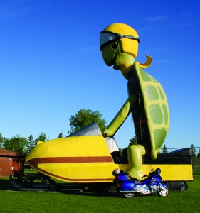
I wandered back into the Turtle Mountains, circling Lake Metigoshe, and then headed south to Bottineau, back on ND 5. There I was greeted by a gigantic turtle riding a huge snowmobile. I had to suppose that this area is popular among the winter-sports enthusiasts. I later learned that the turtle goes by the moniker of Tommy. The aptly named Norway House motel and restaurant gave me a room for the night, and served up a decent T-bone steak—which was probably raised in the county. The state has more than 2 million cattle on the hoof.
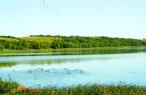
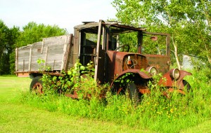
The spring morning was bright and clean, indeed a little crisp. A lot of heat had settled over the Great Plains earlier in the month, but cold arctic air was pushing down and making the temperatures much more pleasant. Now the two lanes of asphalt were leading through the prairie proper, which I find beautiful in its desolation. Every few miles a deserted house would appear, sitting empty on the horizon, often intact except for missing windows and doors…since those could be recycled. In the 1950s many farmers, with the advent of better roads and inexpensive cars, had chosen to live in the local community and commute to their work on the land; it could get lonely out there in the vast openness. Other family farms had been bought up by agricultural corporations, the residents moving to town to find other jobs, the fields only seeing the human side at planting and harvesting.
As I rode farther west, the towns grew farther apart. I passed between Des Lacs (The Lakes), a national wildlife refuge, made a couple of right angles on the highway and noted that the horizon seemed to be even farther away, the landscape opening up even more. A few forever-nodding pump-jacks occasionally stood out in the fields, bringing oil to the surface. I passed by the town of Lignite, once noted for its coal-mining economy, but “brown coal”—as lignite is also known—is not a clean burn, and for the moment the mining has stopped. Just you wait a few years!
Crosby was a county seat, with an appropriately magisterial courthouse commanding the main street. The town, incorporated in 1911, prospered for most of the century with cattle and coal, though it was in an economic slump when I stopped by, yet the residents were friendly and optimistic. The waitress at the café where I had my lunch, a commendable meatloaf sandwich, should be hired as the community’s public relations manager.
By the time I had finished my apple pie, I was almost ready to move here.

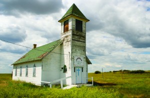
The last town in the state, Fortuna, was slumbering away with a boarded-up church and a few grain silos along the railroad tracks seeming to be the major source of endeavor. Then I was moving on to the broad plains, Montana just a few miles away, Big Sky country ahead. Heck, the skies were pretty big behind me, too.
The Peace Garden State made for some rather good riding. No complaints. Though I doubt I would want to be there in January, unless I could borrow Tommy Turtle’s snowmobile.
[From the September 2006 issue of Rider]


I really enjoyed your writing, very similar to how I like to write about my bike trips. For now, with the virus, I won’t be going very far. I’m 81 in two weeks and still want to be out there on the open road. My Honda 800 Pacific Coast and my Honda ST1100 keep calling to me. Maybe next summer. Thanks, Jon Page. Qualicum Beach, British Columbia Canada.