One of the best things about living in Washington, D.C., is how easy it is to get away from it.
Life in the nation’s capital can be exhilarating, but the nonstop partisan political passions combined with the region’s surplus of type-A personalities (who become type-A drivers every rush hour) can eventually become trying for even the most mellow fellow. That’s when the rolling hills of Virginia and the mountains of West Virginia beckon to the stressed-out motorcycle-riding Washingtonian. And it all can be reached in a determined one-day mind-clearing motorcycle ride.
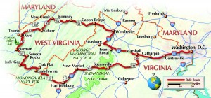
I’m normally a news junky, but today I leave the morning newspaper untouched on the front stoop. I leave in the early daylight on my black 2004 BMW R1150R on an escape route that takes me west out of Washington along Interstate 66 past Northern Virginia’s suburban sprawl. After a half-hour or so, I pick up Route 29 to Route 211, a mostly straight four-lane country highway that runs roller-coasterlike southwest through farm and horse country to where the fun really begins at the base of the Shenandoah Mountain range. It’s a cool but sunny day in prime leaf season; the countryside is dressed in its fall finery and the small communities along the way have donned their Halloween costumes.
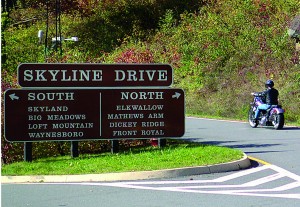
The first stop is Sperryville, Virginia, a small country town at the base of the Shenandoah Mountains, whose businesses appear to thrive on city folk like me stopping in for a break. It’s a good place to poke around any number of roadside stands hawking apples, ciders, jams, syrups and other locally produced goods. I ride off with a jar of Fruit’n Toot’n Virginia Traffic Jam, a delicious concoction of raspberries, blackberries, blueberries and bananas, purchased at a stand right down the street from the store that advertises “Antique Tables Made Daily.”
Route 211 is transformed at Sperryville. Exiting to the west it becomes an extremely twisty two-lane mountain road that wends its way over the Shenandoah Mountains and is a favorite ride of weekend road warriors ready to challenge themselves on its many banked hairpin turns (a fact that has been duly noted by the local constabulary).
On this weekday, however, the road is mostly empty. The few slow-moving leaf-peepers are quickly dispatched by the Beemer’s torquey flat-twin engine at the strategically placed truck lanes. I’m always surprised and pleased with how well the big bike handles the curves; I’m riding quickly for me, but have plenty of lean angle left in reserve.
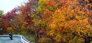
After about six miles of fun up and over the mountain pass, the road flattens out and once again becomes a pleasant ramble that intersects Route 11 and Interstate 81 at the same point. Take either one south (11 for pleasant scenery, I-81 for speed) and pick up Route 33 into West Virginia. As I ride west I pass the edge of a stationary front and clouds now cover what had been a bright blue sky. West Virginia’s mountain ranges still beckon, but some of its peaks disappear into the clouds. As I approach the West Virginia state line the road turns sharply upward and begins to bend and twist over and on top of itself in its effort to flatten the ascent into the Allegheny Mountains. The road is clear at the top of the pass, but the trees are poking into the clouds; aromas of dried leaves and woodsmoke flow into my helmet.
Route 33 jogs north briefly when it joins Route 28, and turns west again when it joins Route 55. I’m now riding through the Monogohala National Forest and past some prime hiking areas, including some of the few federally designated wilderness areas on the East Coast. One of these, the Dolly Sods, was used as an artillery range during World War II. Hikers are advised to stay on the trails and to use existing campsites because they have been cleared of ordnance. Any unexploded shells are to be left undisturbed (!) and reported to the Forest Service immediately.
I turn north onto Route 32, and the feeling of the countryside changes dramatically as I approach the Canaan Valley State Park, home of some of the best skiing in the region. There is now a distinct resort feel and the local businesses clearly cater to a more monied ski crowd. Since the road must accommodate larger crowds during snowy ski season, it’s wider and straighter than most of the other roads I’ve encountered so far.
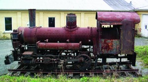
A few miles out of town the road narrows again and heads downhill. The forest here is composed of secondary-growth trees, meaning the original old-growth forest has yet to recover from being clear cut at the turn of the last century. As I approach the towns of Davis and Thomas, remnants of the logging era remain. A rusted-out steam locomotive squats at the side of the road in Davis, while hikers collect rusted detritus along nearby trails that follow the long-abandoned railroad grades loggers blasted into the hillsides to remove trees from the most remote and rugged areas.
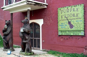
Thomas, a few miles farther down the road, has clearly seen better days as evidenced by the vacant Victorian buildings along its main street. Even so, it’s adapting to its changed economic reality —tourism has replaced the extractive industries and a thriving artist colony makes its home here. It’s well worth a stop in for a late lunch or early dinner at the Purple Fiddle, a funky family oriented organic-food café/bar/bed and breakfast. If you’re lucky, you might hear some live bluegrass while you sip a drink or play a board game.
With the afternoon shadows lengthening, I pick up Route 93 to ride northeast and out of the forest. At Route 50 I point east and head for home. While 50 is a two-lane road, it’s also a major cross-state thoroughfare and is heavily traveled. Coming down out of the mountains, truckers are warned two miles in advance of 15-mph curves and are required to stop and test the brakes before attempting the descent. Even then, deep gravel-filled pits await runaway rigs at the sharpest corners.
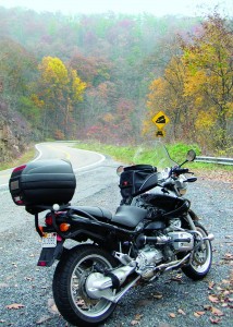
Dusk is falling as I ride out of the mountains and into Virginia, the big twin’s engine compression keeping my speed down as I keep my eyes peeled for midcorner gravel and deer in the failing light. I prepare myself for increased traffic and start my ride back to Washington. Since it’s almost dark now, I hop on I-81 and head south about 15 miles to I-66, which takes me straight back into town in about an hour and a half.
Arriving home tired and stiff from my almost 400-mile ride, I find the Washington Post still waiting for me on the stoop. I pour myself a beer, open the paper, and am ready to rejoin life in the nation’s capital.
