The phrase “Ride North Dakota” doesn’t usually bring a motorcyclist’s blood to a boil. That doesn’t mean that there aren’t any good roads in North Dakota—after all, anywhere we ride on our favorite mode of transport is a good road. Some are just better than others.
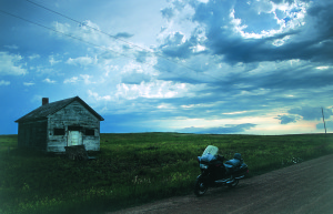
North Dakota has some of my favorite vistas. On this trip, riding west on Interstate 94 from Fargo, the sun rises over my shoulder and the wide-open spaces of the northern plains stretch out in front of me. Grain elevators dot the horizon in every direction like monoliths. The landscape is so stark it seems like the farm fields changing from corn to beans to grain are the only variances in the scenery. The furrows in the farm fields extend out from the highway perpendicularly and click past like fence pickets.
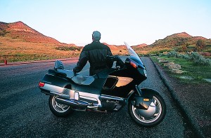
This land is so flat, it seems as if I stood up on the pegs I could see to Montana, but of course I can’t. Then off on the horizon there’s something bright yellow. As I get closer and closer it gets bigger and bigger. Now out of nowhere there’s a field of sunflowers, hundreds of acres of 6-foot tall plants turning the left side of my world into a sea of yellow. Out of the so-called mundane comes the spectacular.
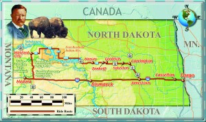
They say open spaces open the mind. This is the eastern part of the state and flat, open spaces are the nature of the landscape. I’m heading for the western fringe of North Dakota to the town of Medora and the Theodore Roosevelt National Park, where the North Dakota Badlands got their name.
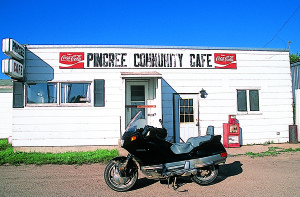
Medora was founded along the east bank of the Little Missouri River by the Marquis De Mores in 1883 and named for his wife. The Marquis was a rich French entrepreneur with a knack for both grandeur and failure, but he never seemed to run out of money from home. He built a meat-packing plant to service the emerging cattle ranching industry in this part of the western plains.
Trying to put a better spin on the name “Badlands,” early Chamber of Commerce types attempted to change the name to Pyramid Park, after the predominant buttes and mesas in the Badlands that resemble pyramids. But one of the early white explorers, General Alfred Sully, described the Badlands as “Hell with the fires out.” Which is very appropriate, as much of the exposed geology of the area has a rosy red glow to it called scoria, formed when layers of coal caught fire and burned, baking the nearby earth to a rich red color. Summers can be brutally hot, over 100 degrees, and winters even worse with temperatures well below zero and winds that never seem to stop. There was just no way they were going to shake the name Badlands.
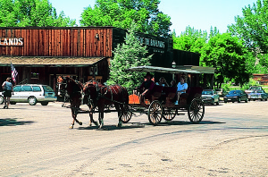
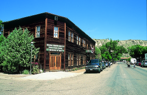
After crossing North Dakota on I-94 I arrive in Medora, which relies upon tourism from the adjacent Theodore Roosevelt National Park. Gone are the cowboys and the cattle ranchers, the steer rustlers and the vigilantes who hung them from the nearest tree. But the old west is still the prominent theme in Medora, with wagon rides and a cowboy on horseback clopping around town for the tourists to photograph. Several of the original buildings, like the Rough Riders Hotel and Joe Ferris’ General Store, still stand. But the town is best known for the Medora Musical. It’s an old-west singin’, dancin’, toe-tappin’, Teddy Roosevelt-themed variety show for the whole family that appears every night at an outdoor amphitheater on the edge of town, with a Badlands sunset for a backdrop. It’s all very corny and very fun. But don’t think of Medora as a tourist trap, as there’s still no water park and only one miniature golf course.
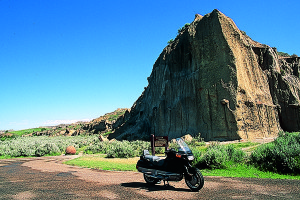
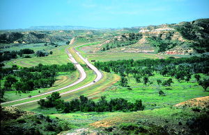
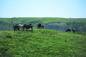
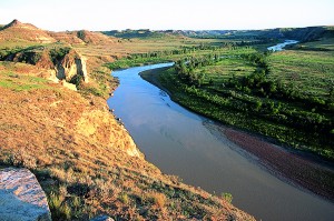
Theodore Roosevelt National Park consists of two separate parks within Little Missouri National Grassland. The south unit is adjacent to Medora and where I first venture into the park. After I pay my entry fee the ranger warns me that the bison who roam the park freely have taken offense to motorcyclists and bicyclists on occasion and that I should keep my distance. That’s fine with me—I’ve always made it a policy to stay clear of 2,000-pound hairy creatures with horns and a bad disposition when I’m on my bike. Inside the park is a 36-mile scenic loop that takes you first along the Little Missouri and then through some of the best (or baddest!) of the Badlands. There are frequent prairie dog towns and overlooks, and of course the bison—which I observed at a distance—a herd of wild horses and one of Roosevelt’s restored cabins from the time he spent here as a cattle rancher.
Roosevelt arrived in this area in September 1883 to hunt wild buffalo while there were still buffalo to hunt. When he got off the train it was clear to the locals this was a “city dude.” He was a thin, fresh-faced easterner with a moustache and, of all things, glasses, which the folks of Medora considered to be a sign of “a defective moral character.” Roosevelt set out to arrange for a hunting guide, but because of his appearance was turned down over and over again. He finally contracted with Joe Ferris, whose descendants still live here in Medora.
After a 10-day hunt in the rain and mud, which exhausted Ferris but only seemed to enliven Roosevelt, he finally got his buffalo. Roosevelt earned the respect of the Ferris’ and friends because of his tenacity and determination on that hunt. They saw that in spite of his inexperience, he clearly was no “dude.” On that trip Roosevelt decided to buy some land and to raise cattle in the badlands. That same determination continued to mark Roosevelt as an exception to the normal easterner throughout his tenure in the badlands. He gained respect as a hunter, rancher, horseman and community leader. Roosevelt’s experiences in North Dakota had a profound impact on his life. In 1910 he told a crowd in Fargo, “If it had not been for what I learned during those years…here in North Dakota, I would never in the world have been president of the United States.”
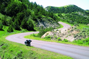
After a short trip back east on the interstate I head north on Highway 85 for about 45 miles to the North unit of the Theodore Roosevelt National Park. The 14-mile scenic drive has a much different flavor than the South Unit. You start out in the Little Missouri River valley and follow along its shore for a few miles. This view is from the bottom looking up, unlike the South Unit’s drive looking down into the valleys. The road winds through rock formations and sagebrush and then begins to climb out of the river bottom and up onto the grasslands.
Once on top the character of the road changes. This road wasn’t engineered, it was composed. Most twisty roads are that way because of obstacles that need to be gotten around or over. Here, there’s nothing in the way, only the rolling grasslands of the western plains. This road could have been very straight with only a few bends but it has a flow that few roads have. It’s as if an enticing ribbon of asphalt was loosely draped across the landscape.
When I leave the Theodore Roosevelt National Park north unit I continue north on 85 to Waterford and East on 23. It doesn’t take long to leave the spectacular geography of the Badlands and get back to those wide-open spaces, still the land has a gentle and continuous roll to it. Now I’m riding along the north edge of the Fort Berthold Indian Reservation and I come across a celebration of some sort. It was never quite clear to me exactly what the observance was for, but there were crafts for sale and dancing in full native Indian costume and drums everywhere.
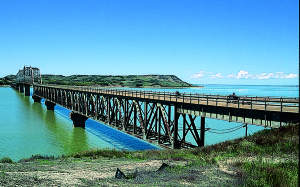
I leave the powwow and head east to cross Lake Sakakawea, which is the reservoir created by the Garrison dam on the Missouri River. The lake was named for the Indian guide of the Lewis and Clark expedition, and the whole area is rich with the history of their journey. I turn south on 37 to 1804 and back to 37 in an attempt to follow the eastern shore of the lake. The roads here are string-straight, and the lake obviously is not, so it ducks in and out of my view as I head east again. I turn south on Highway 83 and then back east on 200—this leads me through a string of small towns—Mercer, McClusky, Denhoff, Goodrich, Hurdsfield, Chaseley and Sykeston. All small farming villages with a gas station and a grain elevator surrounded by small homes of people who weather this rugged land 365 days a year.
Highway 200 turns into 52 and swings southeast to Jamestown, where I pick up the interstate and track back eastward. Although I’m back on the superslab, the North Dakota marvels haven’t yet come to an end. I stop for an impromptu air show by a crop duster and finally, just off exit 331, is the Casselton Can Castle, an architectural marvel of the roadside art genre, built from discarded tin cans. It just doesn’t seem to make a difference where I travel, even across North Dakota and back. As long as I’m on my bike the trip is filled with spectacle and awe.
More Information:
Theodore Roosevelt Medora Foundation
www.medora.com
(800) 633-6721
Theodore Roosevelt National Park
www.nps.gov/thro
(701) 623-4466
Discover North Dakota
www.ndtourism.com
(800) HELLO-ND
(This Ride North Dakota! article was published in in the October 2003 issue of Rider magazine.)
